AUSTIN, Texas — After a round of widespread heavy storms several days ago, we’re still not done with storms for this week.
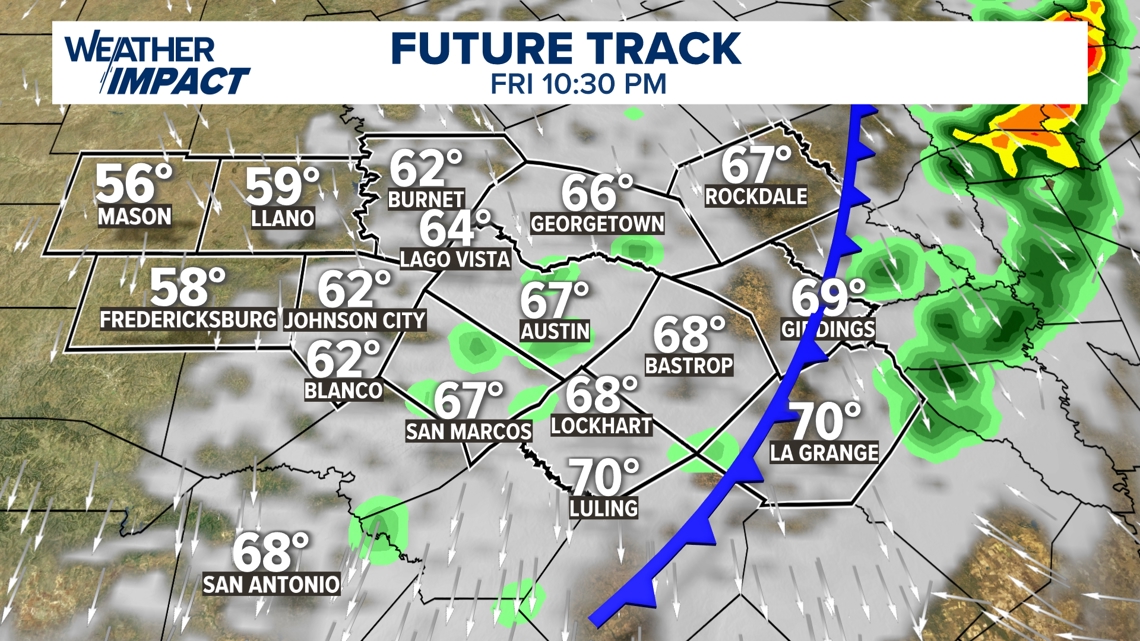
A cold front will slide into Central Texas on Friday, bringing with it a broken line of showers and storms. Unlike our last system, this will not be a situation where everyone gets heavy rain, but we still have some scattered storms in our forecast.
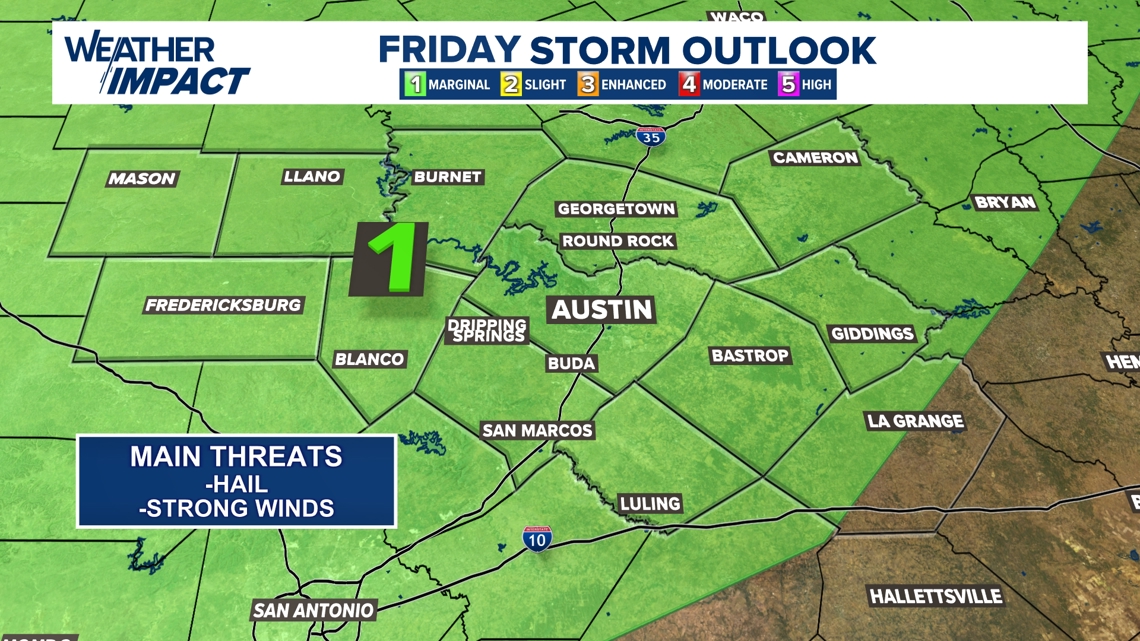
There’s also a low-end risk for one or two severe storms. The Storm Prediction Center includes most of the KVUE area in a “marginal” – level 1 of 5 – severe risk. If any severe storms develop, the main threats will be hail and strong winds. There’s also a very low chance for a brief tornado.
Make sure you have the KVUE app downloaded so you can receive any weather alerts issued!

The front will first move into the Hill Country in the early to mid-afternoon hours, and storms could be strong to severe. Ahead of the front, afternoon temperatures will reach the low to mid-80s, but the numbers will be cooler in the Hill Country after.

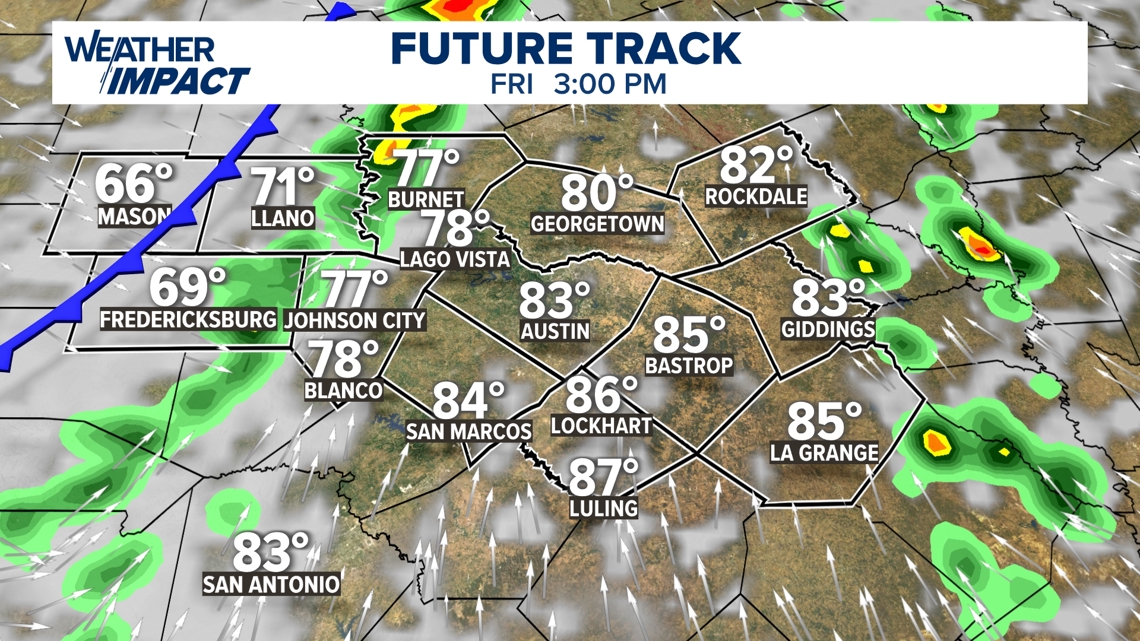
The front will pass into the Austin metro and Interstate 35 corridor in the late afternoon into early evening. It’s uncertain how widespread the storms will be as they arrive in the metro. Again, not everyone is guaranteed to get rain, but there could be a few strong storms in the city.

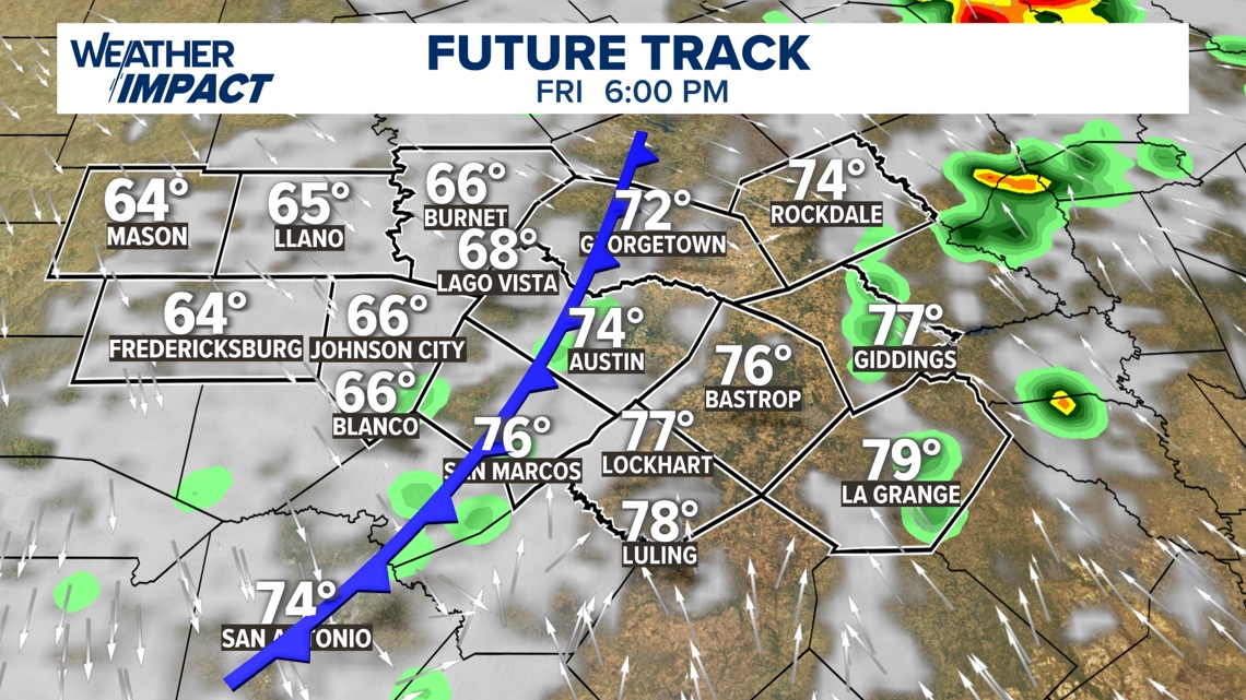
By early evening, the front will move east of I-35 into the Coastal Plains. The higher humidity could result in a slightly higher severe weather concern, but the front will move out of our eastern counties by midnight.


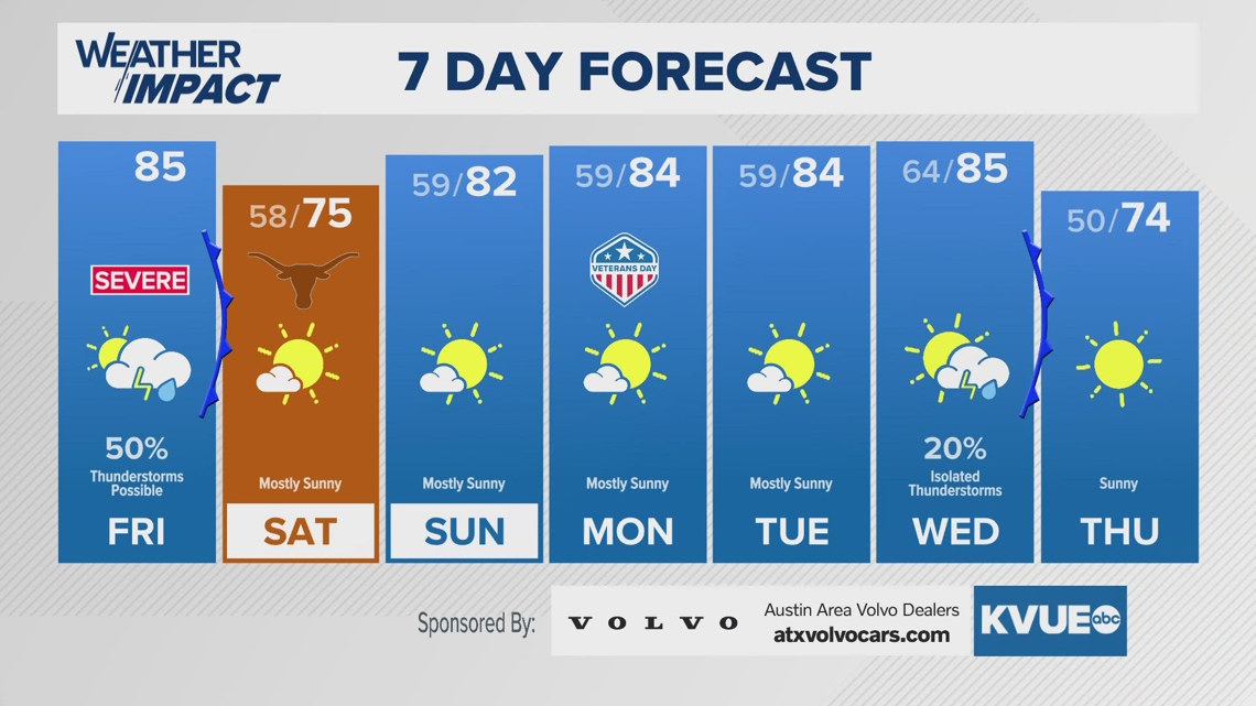
Behind the front, the weather looks fantastic Saturday for the Texas-Florida game.
The KVUE Weather Team will continue to closely monitor this developing forecast.
In the meantime, the extended forecast can be found below:

