AUSTIN, Texas — It’s another Thursday in Central Texas, and that means a new drought monitor has been released.
With last week’s rain, we’ve seen statewide improvements. That’s to be expected given the amount of rain we saw, especially in sections of the Big Country, off to the west of the KVUE viewing area. That region saw some of the highest rainfall totals.
This is part of a 5% improvement from the past week in areas not in any drought designation. Additionally, the state’s “moderate” drought area is now 8% smaller than last week, and areas in the “severe” drought category decreased by around 3%.
However, there were some areas that saw some drought regression, especially in the Big Bend region. In that area, the two highest drought designations, “extreme” and “exceptional,” increased by 1.5%.
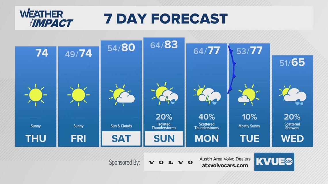
But there is a silver lining to the lack of improvement in our drought situation. We are tracking another cold front arriving Monday – possibly in the evening, though timing will have to be fine-tuned – that is expected to bring better storm chances, especially as the front gets closer.
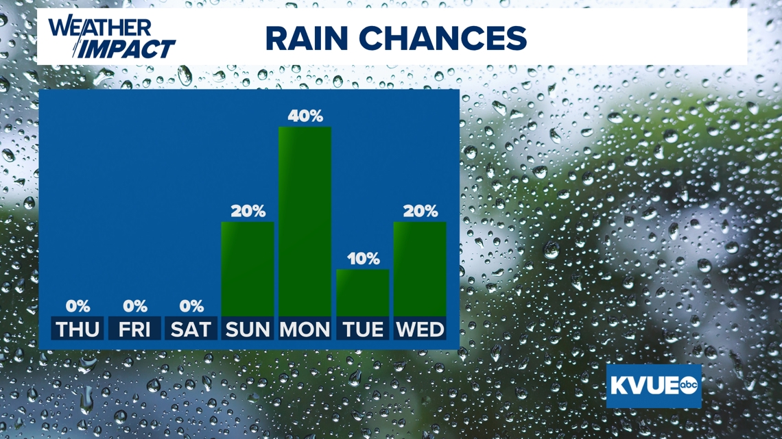
We’re tracking a 20% storm chance for Sunday and a 40% chance for Monday, and all of that rain is likely to be counted before the 7 a.m. Tuesday cutoff time for the next drought monitor.
Some areas may get 1.5 to 2 inches, according to the latest model guidance; however, that may have to be tweaked as the system gets closer.


As always, stick with the KVUE Weather Impact Team for all the latest on your forecast.
Your seven-day outlook is below.

