AUSTIN, Texas — Winter is certainly making its presence felt across the Lone Star State this week.
Cold weather has already descended into Texas, but next up we’re tracking a weather-maker that will bring precipitation to our forecast starting Wednesday night into Thursday morning. For parts of the KVUE area, a wintry mix will be possible, and for our friends in North Texas, quite a bit of snow could fall.
Before we get into the details, we want to emphasize that this is a very fluid forecast for our KVUE area, and we fully expect some things to change between now and Wednesday night. We advise checking in regularly with the forecast to make sure you have the most up-to-date information.
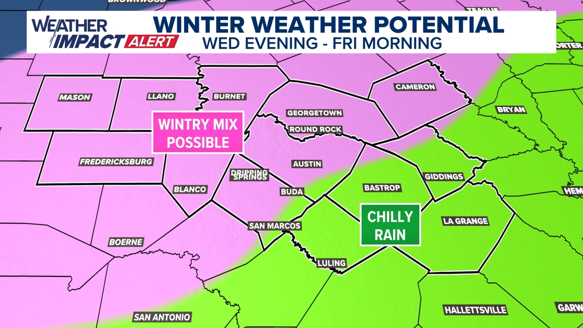
As of now, our latest thinking is that the highest likelihood of a wintry mix will be along and west of the Interstate 35 corridor.
Meanwhile, a soaking cold rain is in the forecast for southeastern portions of our area. The highest likelihood for predominantly snow is likely to stay just northwest of our area. When we say “wintry mix” in this particular setup, we are mostly likely to be dealing with sleet or freezing rain with perhaps a few snowflakes mixed in.

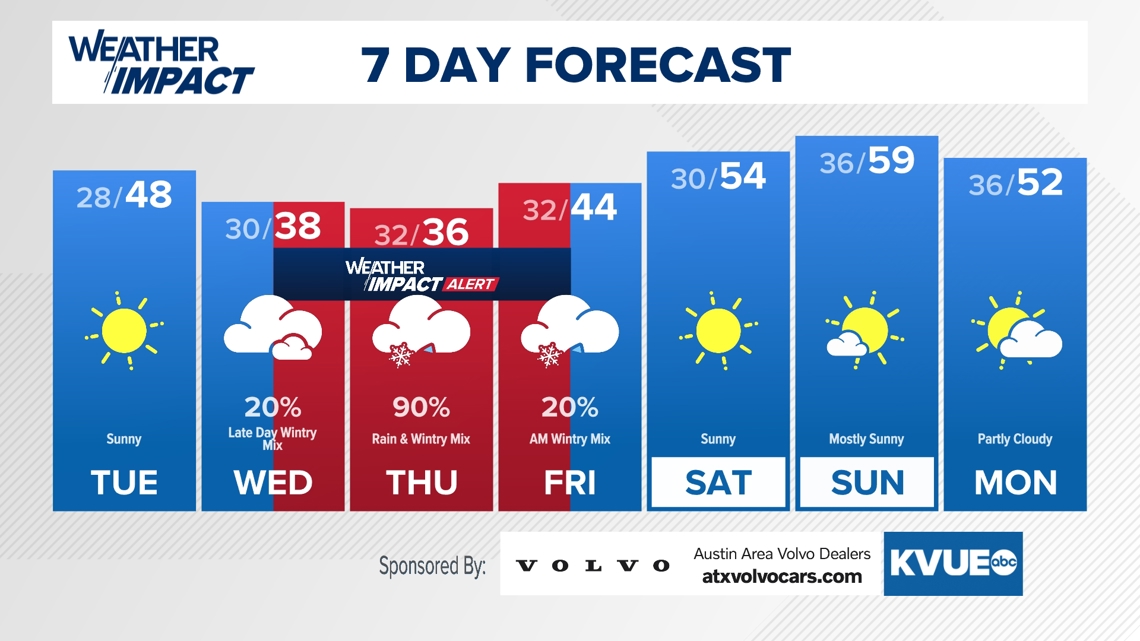
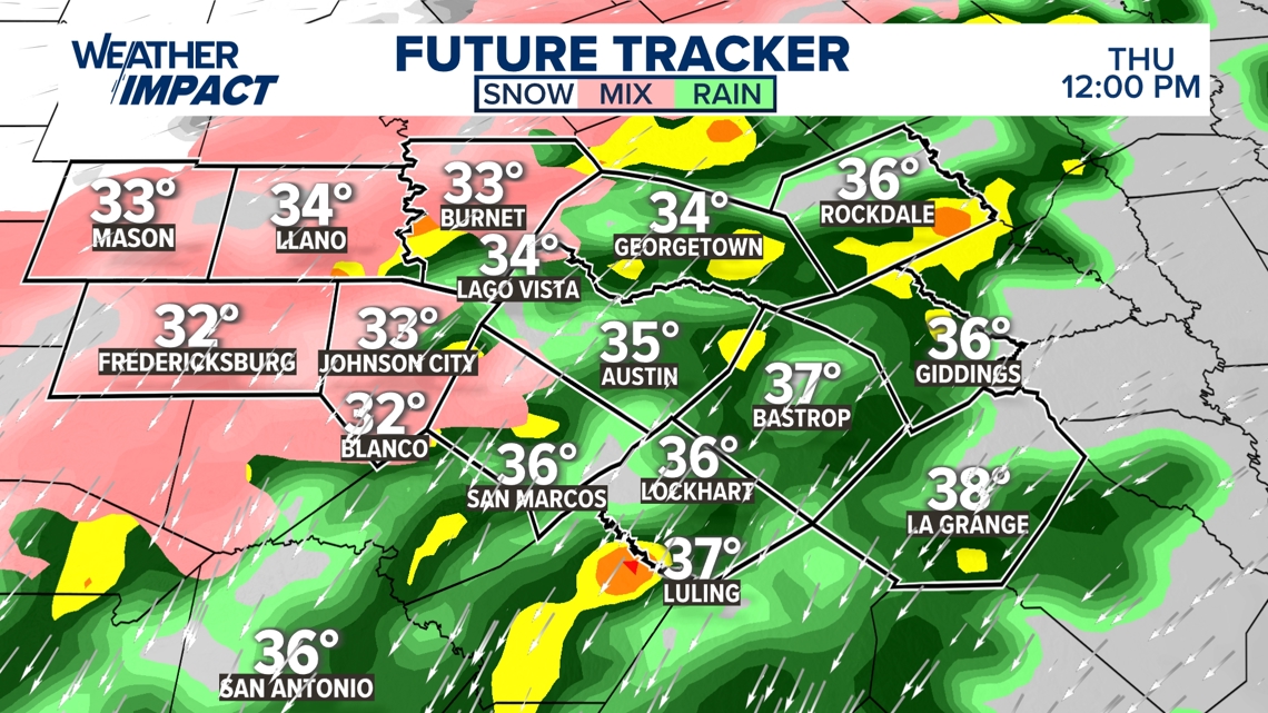
Timeline: Wintry mix first moves in Wednesday evening
Details on the timing for our wintry precipitation chance are now coming into better focus. Most of the day on Wednesday will be dry with just a small chance for a wintry mix shower or a quick flurry.
Wednesday will be cloudy with afternoon highs only in the mid- to upper 30s. Once the sun goes down, temperatures will drop down towards freezing or below in the Hill Country as the first precipitation moves in after about 10 p.m. Wednesday.

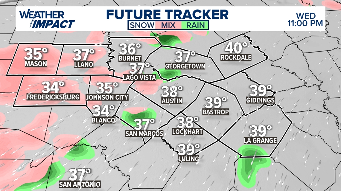
Precipitation will become more widespread through Wednesday night into Thursday morning. By Thursday morning, the wintry mix line will likely be approaching the I-35 corridor. This is a forecast where 1 or 2 degrees will be very consequential.
It’s possible that Austin sits at 33 and narrowly avoids icing, but it’s also possible that Austin drops down to 32 and sees light icing begin Thursday morning. Again, we will have more concrete answers about this forecast by Tuesday afternoon.

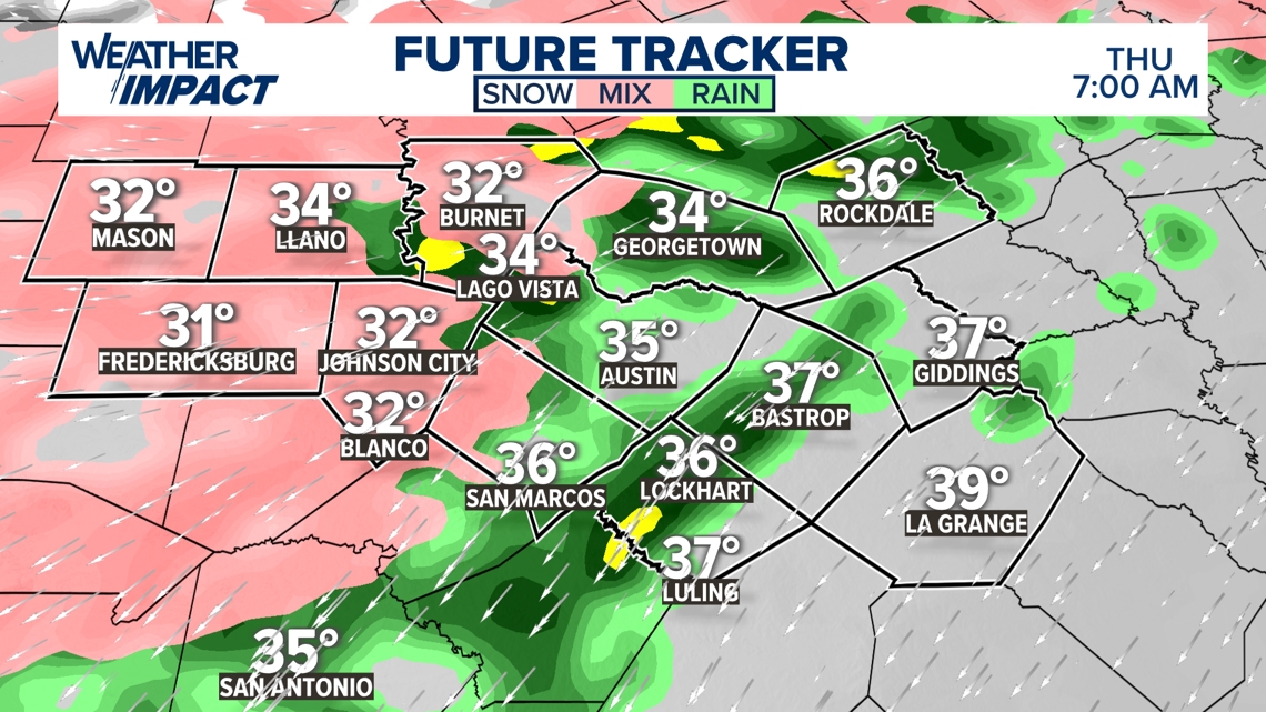
A wintry mix will likely continue through much of the day on Thursday across parts of the Hill Country. Ice accumulation, sleet accumulation or even some light snow accumulation could create slick travel in spots, especially on elevated surfaces.
As of now, it appears that Austin and points southeast will be able to warm just above freezing for Thursday afternoon, but could then drop back down below freezing Thursday night into Friday morning.

The precipitation will eventually end from west to east Thursday night into Friday morning. Wintry precipitation issues could continue through parts of Central Texas, especially the Hill Country, until the system moves out early Friday morning.
Then, Friday afternoon will warm well above freezing with temperatures in the mid-40s, and this should put an end to any Central Texas travel concerns. However, significant travel issues may persist through Friday for much of North Texas where several inches of snow could still be on the ground.
The KVUE Weather Team will continue to closely monitor this developing forecast. In the meantime, the extended forecast can be found below: