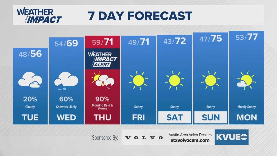
AUSTIN, Texas — It’s been a cloudy, cool, and damp start to the week in Central Texas, but we’re now looking ahead to much higher rain chances later this week.
A big upper-level storm system has been parked out west over the past several days, but this storm system will finally shift eastward into the Lone Star State by Wednesday into Thursday. As this takes place a severe weather threat and minor flood risk will develop over our area.
Ahead of this storm system, the KVUE Weather Team has issued a Weather Impact Alert from 12 a.m. to 12 p.m. Thursday. This is due to both severe weather potential and flooding concerns. As of now, we ask that everybody continues to closely monitor the forecast as we fine-tune the details in the coming days.

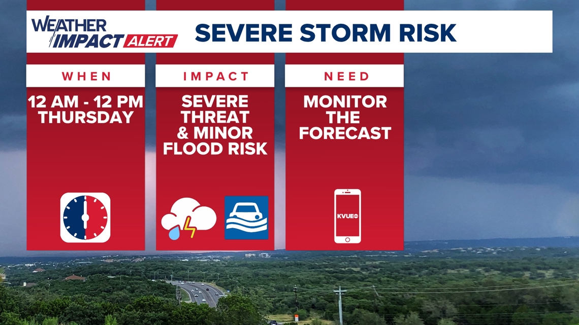
As of now, the Storm Prediction Center includes the majority of our area in Level 2 of 5 “slight” severe weather risk for Wednesday night into Thursday morning. The main risks will be strong winds and hail, but an isolated tornado also cannot be completely ruled out.


Timeline: When to expect the storms
Through the day on Wednesday, there will be widespread rain showers, but the odds of severe weather through the day look quite low.
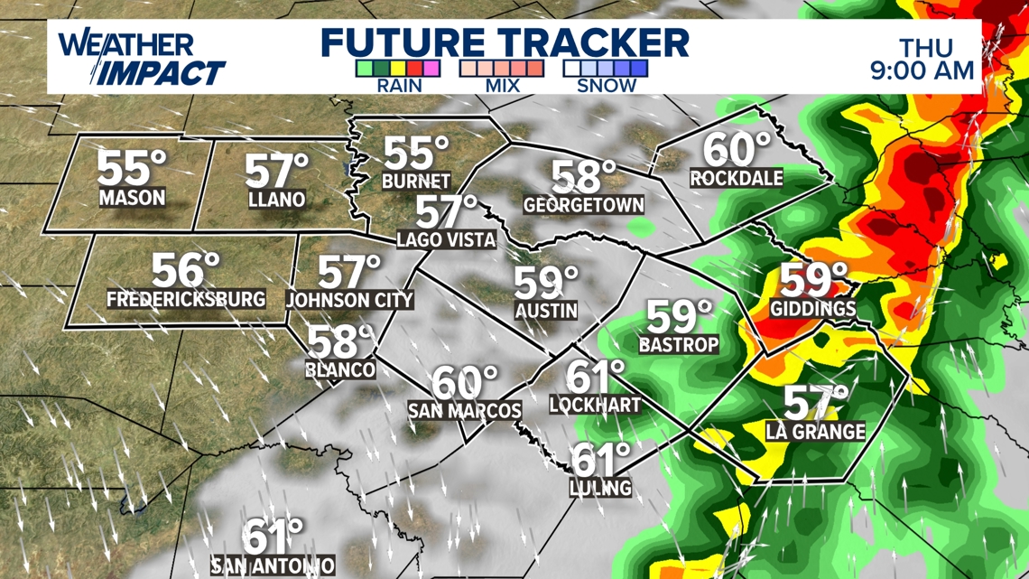
The primary severe weather window will open up around might Thursday, at which point a line of strong to severe storms could be initially moving into the western Hill Country.

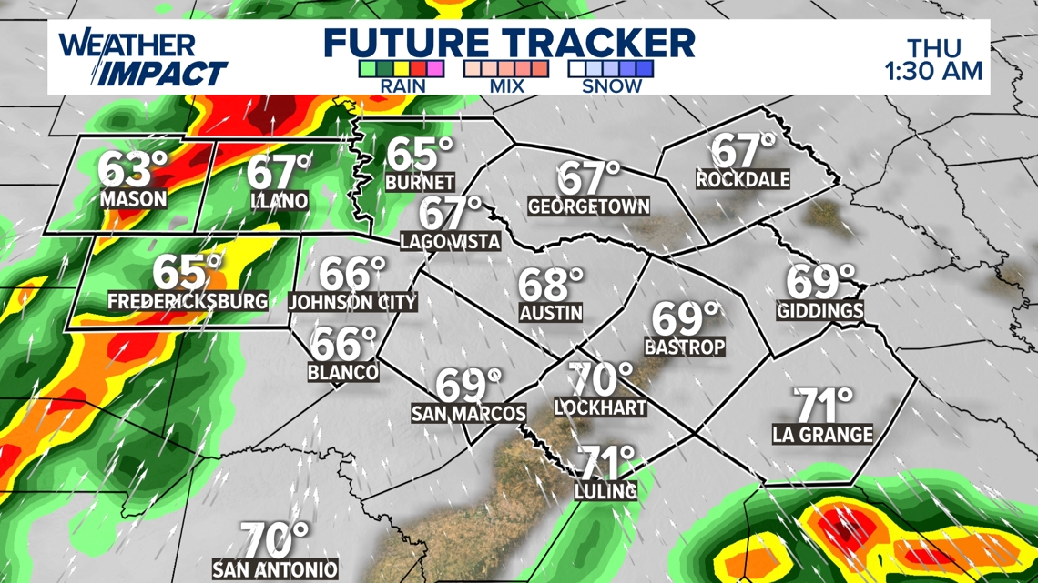
The line of rain and storms will move from west to east across our area Wednesday night into the early morning hours of Thursday.
The exact timing remains fluid, but as of now storms look poised to impact the Austin metro and the I-35 corridor starting as early as about 4 a.m. Thursday. Again, these storms could be strong to severe and could bring some minor flooding around the early morning commute hours.

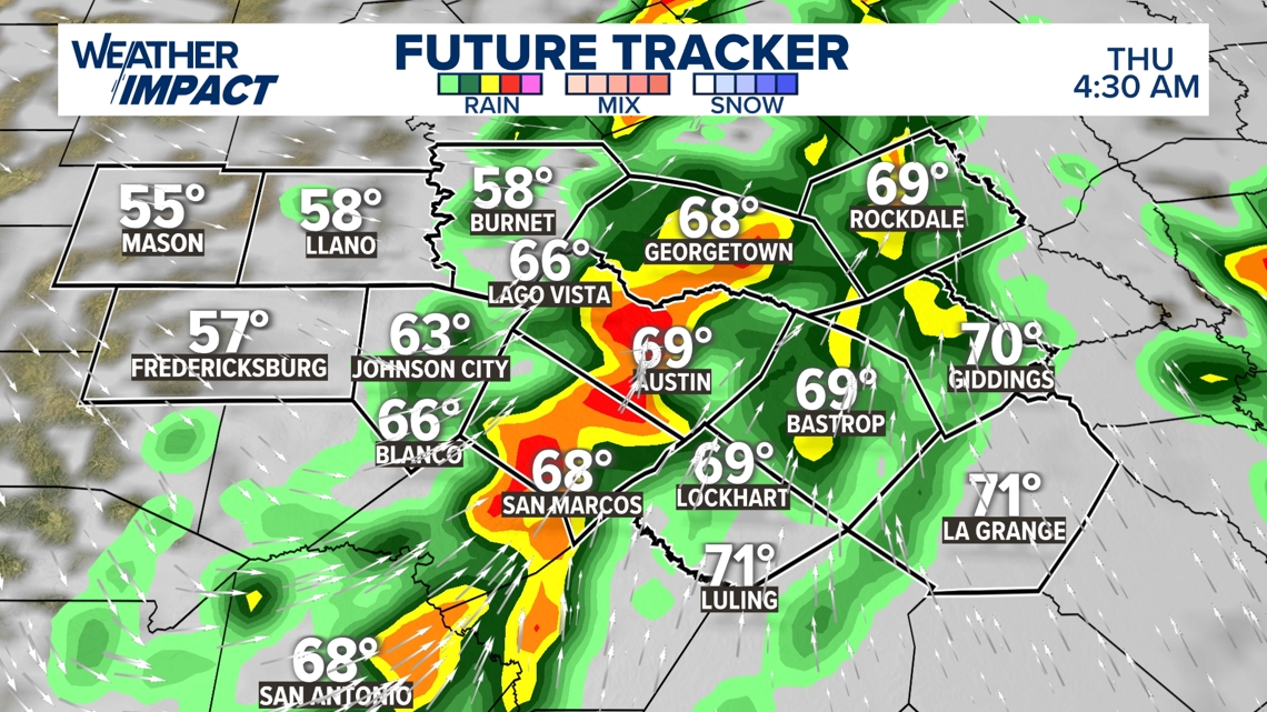
The line of showers and storms will be shifting into the coastal plains and Highway 77 corridor during the mid to late morning hours of Thursday.
The latest model data shows that the severe weather threat will be entirely east of the KVUE area by about noon on Thursday.

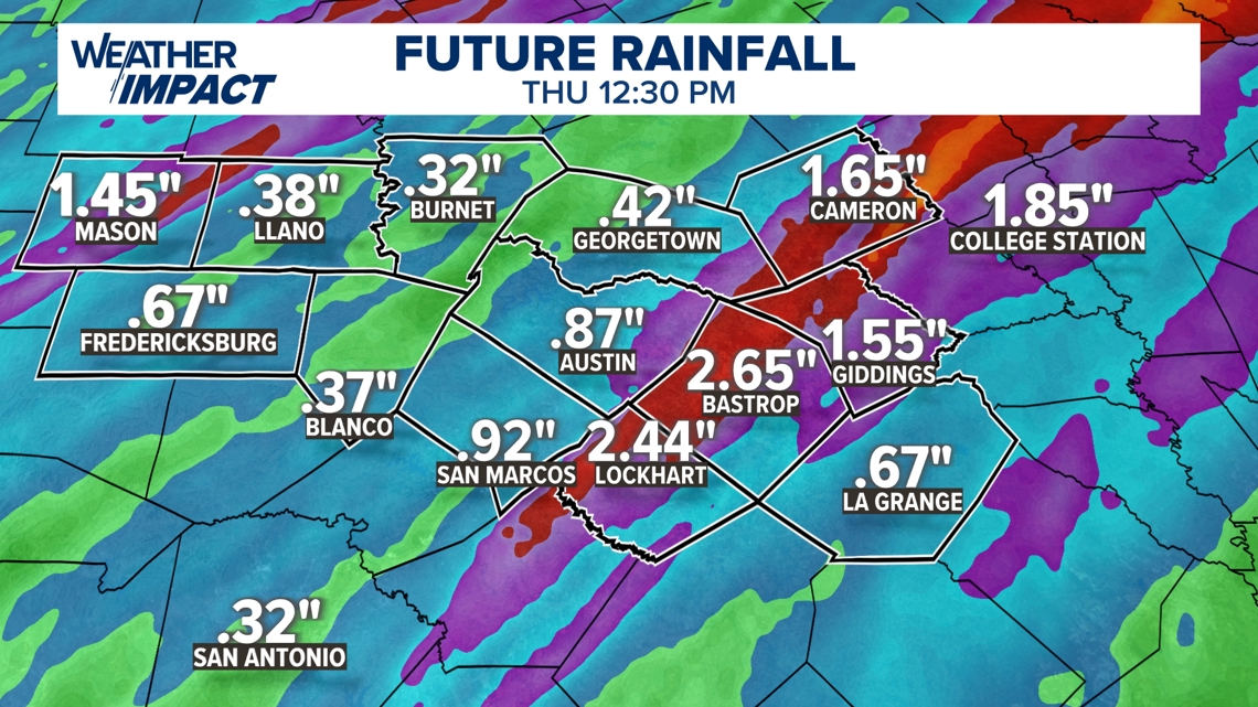
Rainfall totals and minor flood threat
We are certainly in need of some rain here in Central Texas, but we also need to keep an eye on the flood threat. The odds of significant flooding in our area are decreasing based on a more northerly track of the upper-level storm system. With that being said, a widespread 0.5 to 2 inches is still in the forecast, and isolated pockets of 2 to 4 inches are still possible.
As of now, the Weather Prediction Center includes most of our area in a low-end Level 1 of 4 flood threat.

The KVUE Weather Team will continue to closely monitor this developing forecast. In the meantime, the extended forecast can be found below: