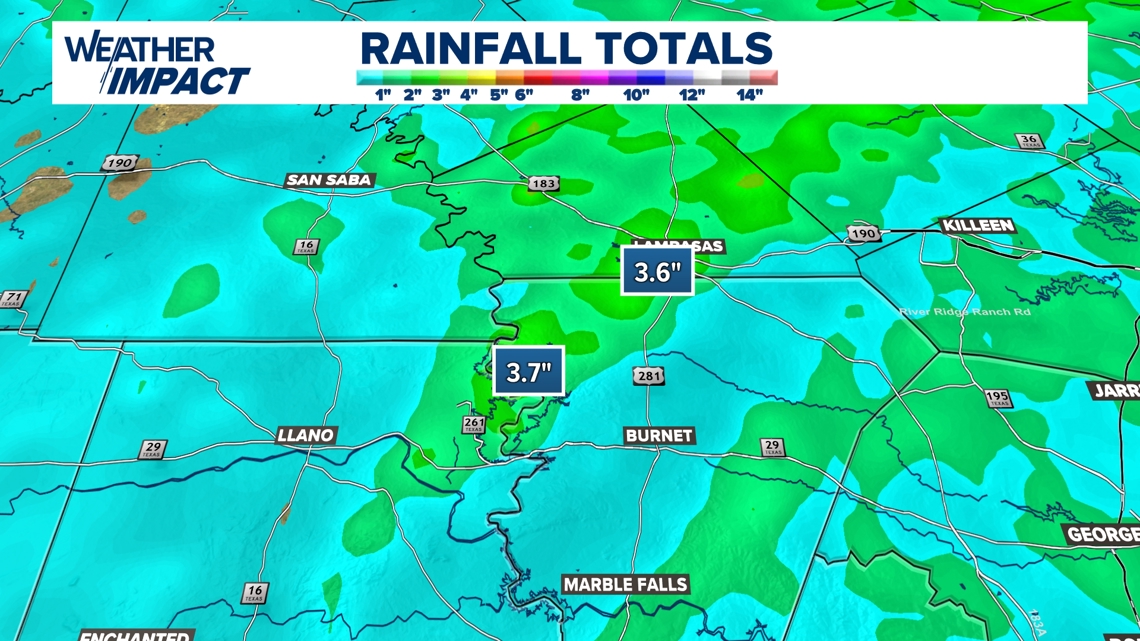
AUSTIN, Texas — It’s been a dreary few days in Central Texas, though we desperately needed the rainfall to help our drought situation. Some may be happier to see the sun’s return than others – areas in northern Llano and Burnet counties, including the area north of Lake Buchanan, got up to 3.5 inches over the past week, according to rainfall estimates!
However, we’ve got a nice change of pace coming with mostly sunny skies and warmer temperatures in the forecast.

Here’s what we’re tracking.
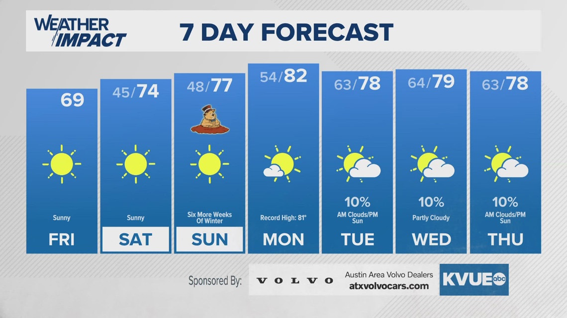
Pleasant Friday into Saturday
We’re expecting clear skies for the next few days, including Friday, with highs getting to around 70 in most spots across Central Texas. However, we expect to be a bit breezy, with a northwest wind that could get up to around 20 mph, with gusts up to 35 mph.
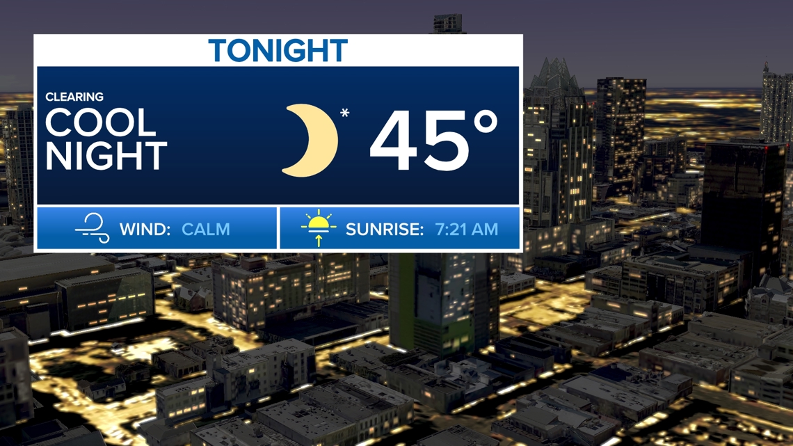
We do expect to be cooler Friday night, with lows in the mid-40s, but we expect calm winds as the wind pattern starts to shift.

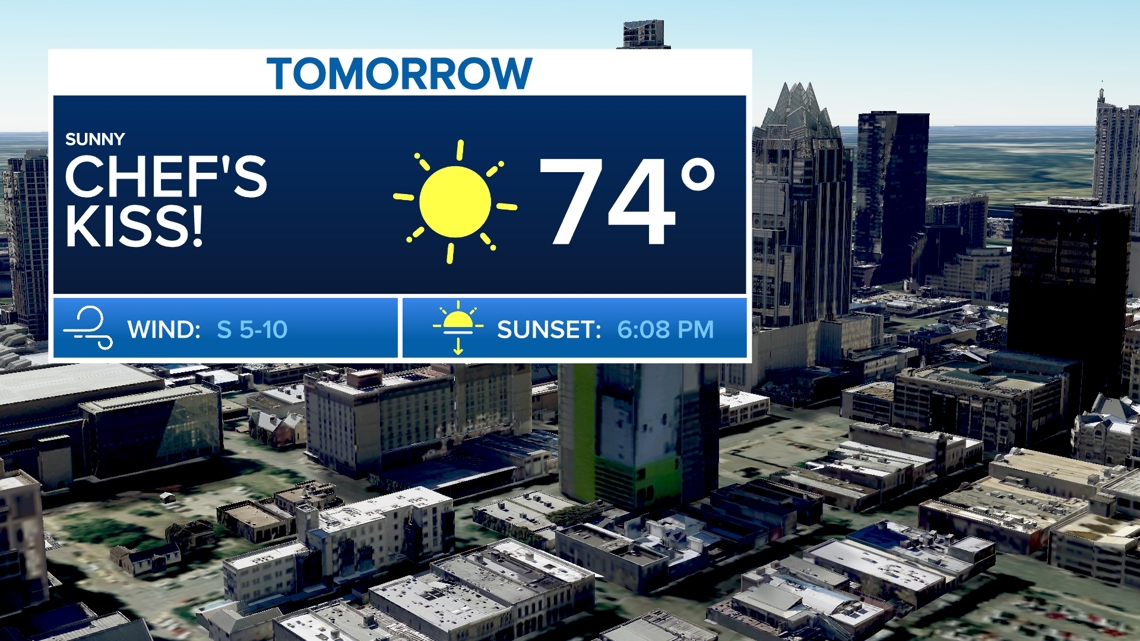
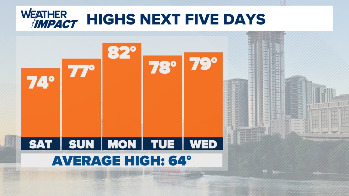
Once the winds complete their shift to a more southerly flow, this will allow for highs to get slightly warmer for Saturday afternoon than Friday afternoon. We’re tracking highs in the mid-70s with a light southerly breeze for the afternoon – a bit of a prequel to spring!

Groundhog Day into next week
As we head into Sunday morning, our friend Bee Cave Bob will make his spring prognostication as Groundhog Day is celebrated worldwide.
We’re tracking another clear start with lows in the lower 50s, so we project Bee Cave Bob will see his shadow, predicting six more weeks of winter.


But the KVUE Weather Impact Team is made up of better forecasters than an armadillo, so we’re tracking warmer temperatures for Sunday into most of next week, with Monday being the warmest day. In fact, Monday’s daily heat record of 81 could fall, as we’re tracking a high around 82.

All in all, it should be a pleasant next few days, but we could still be tracking an isolated shower for the middle and latter portions of next week. Stick with KVUE for all the latest on your forecast as we warm up for the weekend.
Your seven-day outlook is below: