AUSTIN, Texas — Our cloudy, dreary weather is about to turn more active as multiple rounds of rain and storms are expected Tuesday and Tuesday night. While widespread severe weather isn’t anticipated, a strong storm or two can’t be ruled out, along with pockets of minor flooding.
Rain and a few storms likely Tuesday
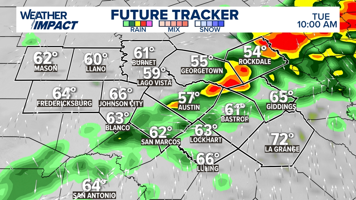
After fog, drizzle and light rain on Monday night, higher rain and storm chances kick in Tuesday morning. A broken line of showers and storms is likely to develop across the Hill Country early in the day, moving west to east through mid- to late morning and into the early afternoon. There’s now a 80% chance of rain for Tuesday, with most areas seeing at least some precipitation.
Temperatures will remain cool, with highs in the mid- to upper 50s across the KVUE area. The stalled front from Super Bowl Sunday will nudge back north, but Central Texas should stay on the cooler side of the front.

Another round of stronger storms Tuesday night
Another round of showers and storms is expected Tuesday night. Although the Storm Prediction Center hasn’t issued a formal severe weather threat, this second batch may be stronger, with the potential for hail, gusty winds and locally heavy rain.
By Wednesday morning, the storms should clear out.

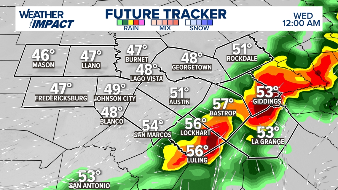
There is also a minor to moderate risk of heavy rain and localized flooding through Tuesday night. Since 8 a.m. Tuesday Bastrop, Fayette, & Caldwell counties have been added to low end risk for severe storm potential too.

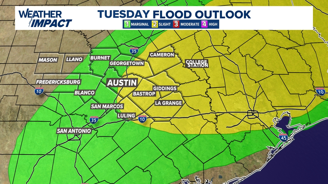
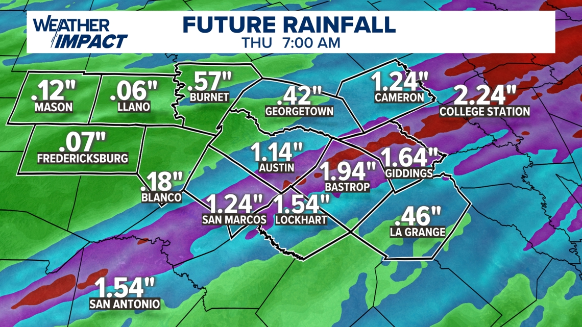
Rainfall totals of 1 to 2 inches are possible, particularly for Austin and areas southeast.

After several cool days, Wednesday afternoon will bring a brief warmup, with highs soaring into the mid- to upper 70s. But don’t get too comfortable, as another strong cold front moves in Wednesday evening.
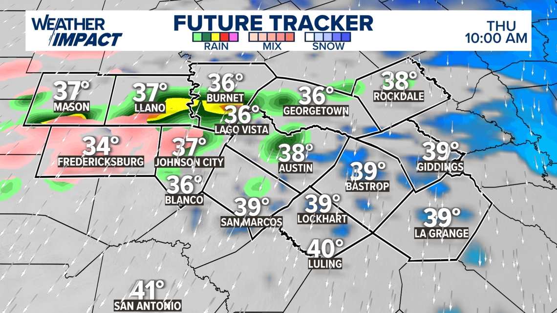
Sneaky winter weather threat on Thursday
This front sets the stage for a forecast worth watching on Thursday. A light freeze is expected in the morning, with temperatures warming into the 40s by the afternoon with a few scattered showers.
So, where’s the sneaky winter weather threat? Some models suggest precipitation may develop Thursday morning. If temperatures dip to freezing overnight and precipitation arrives early on Thursday, there could be a risk of freezing rain, particularly in the Hill Country and along the northern Interstate 35 corridor during the first half of the day.

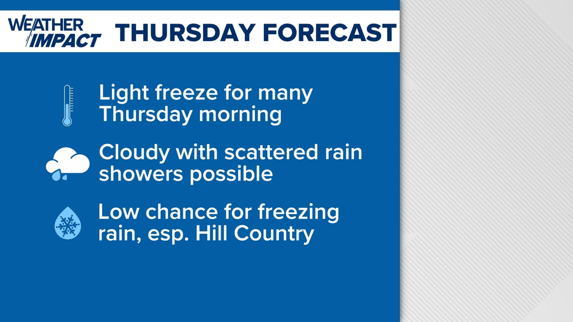
To be clear, this remains a fluid and tricky forecast. The chances of freezing rain are currently low, but we’ll be watching trends closely. Stay tuned for updates.

The KVUE Weather Team will continue to closely monitor this developing forecast.
In the meantime, the extended forecast can be found below:

