AUSTIN, Texas — While we’ve been largely spared of any devastating wildfire impacts from Tuesday’s historically extreme wildfire conditions, we’re not totally out of the woods yet when it comes to fire weather concerns, especially as we head into Thursday.
Here’s what we’re tracking.
Elevated fire weather Thursday
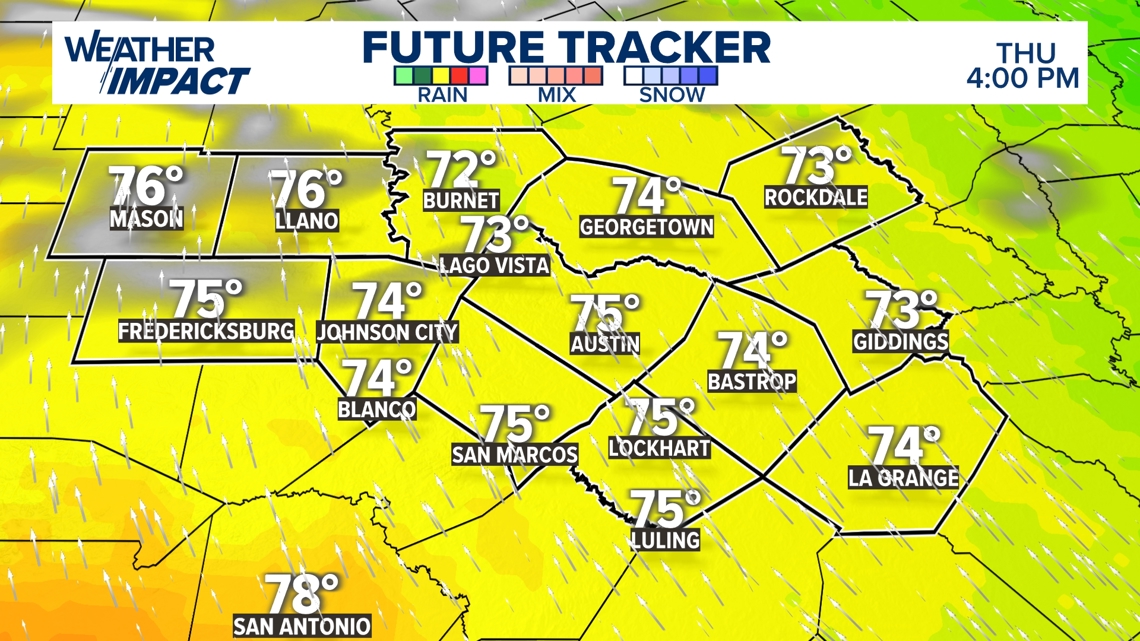
We’re tracking another warm afternoon across Central Texas for Thursday with highs similar to Wednesday, with highs in the lower 70s across much of Central Texas. With that southerly flow, we won’t be surprised if some spots get to the mid-70s.

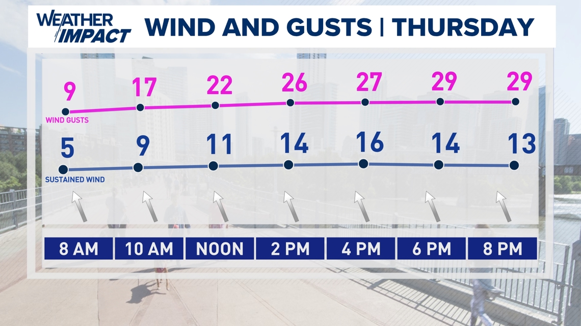
We could have winds gusting to around 30 mph to 35 mph at times during the afternoon hours. While it will not be as windy as Tuesday, where we had sustained winds at about that speed and gusts close to 60 mph, it will still feel noticeable.

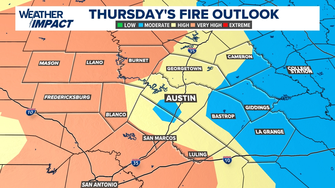
With the winds and the dry soils still in place as a result of this past fall’s flash drought, we’re tracking elevated to near-critical fire weather conditions for Thursday afternoon. While this is not as extreme as the fire danger we had on Tuesday, this is still something that we need to take seriously. It’ll be important to not burn anything outside for any reason, and also to be mindful of anything that may cause a spark.

Stick with KVUE for all the latest on this forecast.
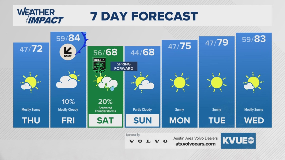
Your seven-day outlook is below.