AUSTIN, Texas — This week was a reminder of just how dry Central Texas has been.
We saw multiple days of fire weather danger, which cropped up due to high winds and low humidity. Unfortunately, those days are not over yet.
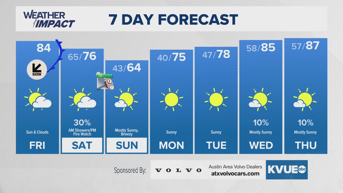
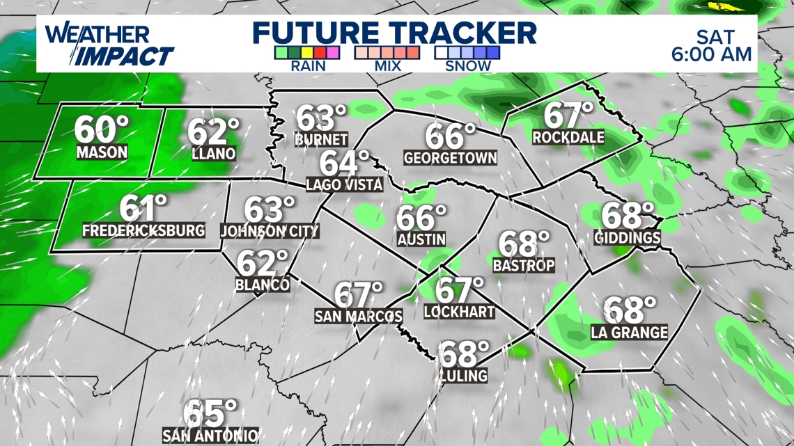
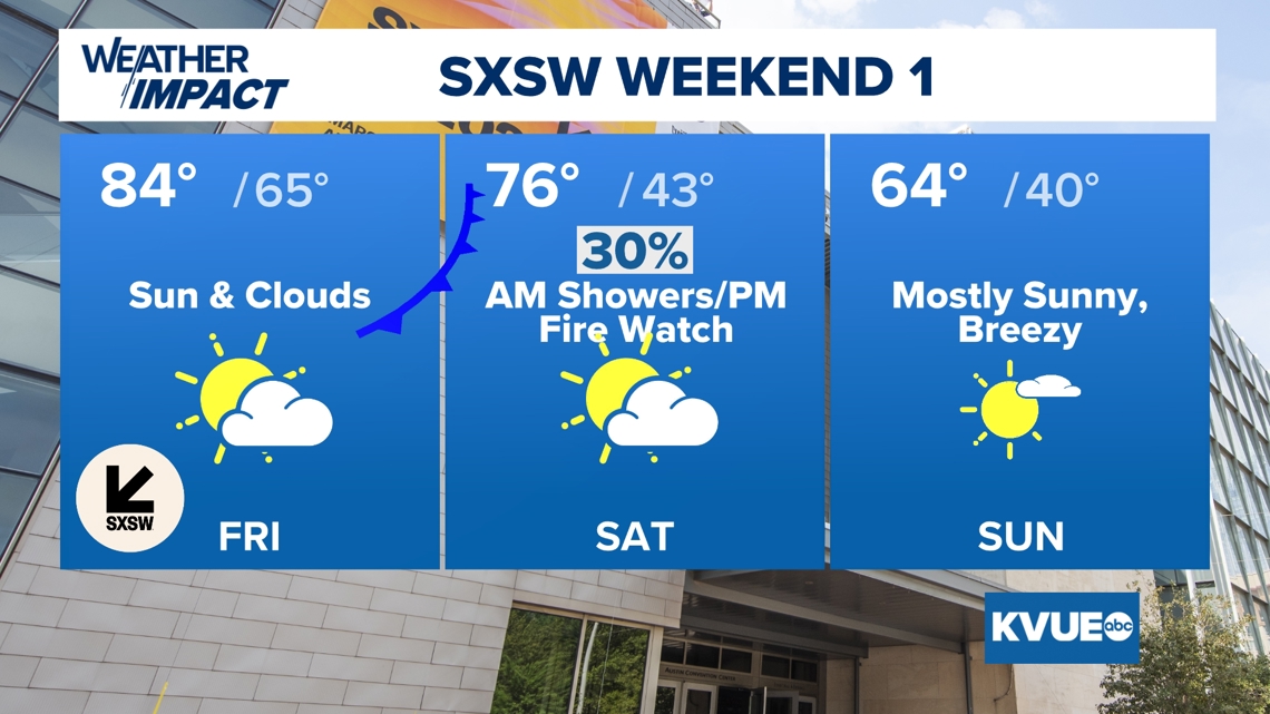
Conditions on Saturday will start muggy, cloudy, and warm. Ahead of the boundary, there will be a 20 to 30% chance for scattered showers. Then in the afternoon, a cold front will pass through our area, boosting high winds and bringing with it another round of dry air.
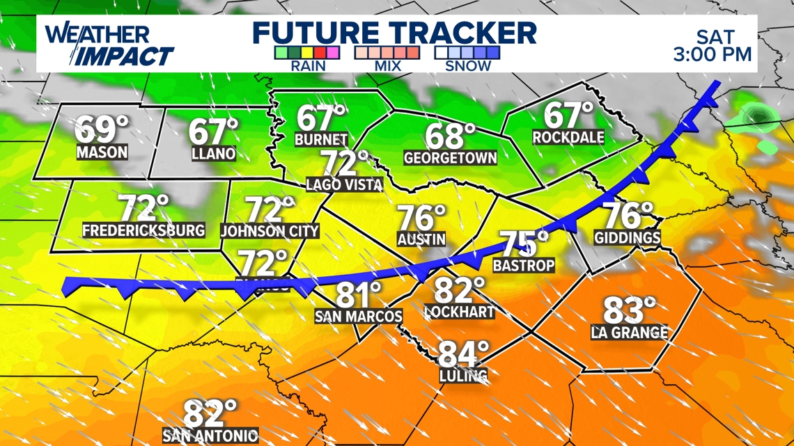
By noon, the cold front will be on the western edges of our area, shifting fully through Central Texas by the late afternoon. It should still be a comfortable afternoon overall, with eastern areas able to get up to the lower 80s.
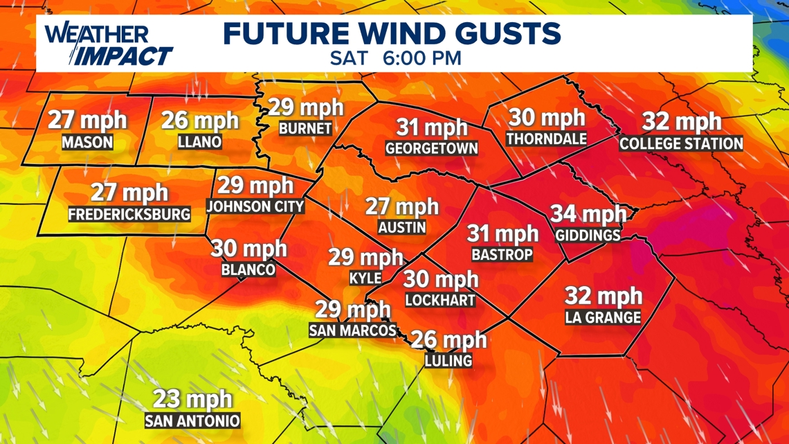
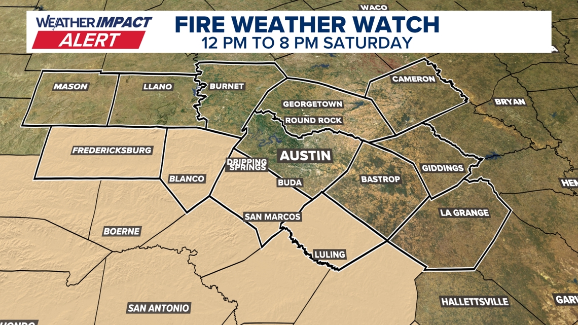
Breezy northwesterly winds will fill in behind the front. Gusts will range from 25 to 35 mph while relative humidity will be between 10 to 20%. The Fire Weather Watch goes into effect at 12 p.m. and will continue through 8 p.m.
Future track of conditions at 6 a.m. Saturday

Future track of conditions at 3 p.m. Saturday

Future wind gusts Saturday at 6 p.m.

Areas under a Fire Weather Watch on Saturday

SXSW Weekend 1 forecast
The “cold” from the cold front will filter into Central Texas overnight Saturday, with temperatures in the 40s to start Sunday. The afternoon will feature cooler weather, too, with highs ranging through the lower to mid-60s, with sunny, clear skies expected. Minor breezes will continue on Sunday as well for the first weekend of South by Southwest.
This likely won’t be our last time tracking fire weather danger this March. Next week will feature warming temperatures with dryness to continue.

Weekly outlook for Central Texas