AUSTIN, Texas — While we continue to track the Crabapple fire in Gillespie County, which has burned over 8,600 acres, we’re expecting fire weather conditions to improve for Sunday. But fire risk will ramp up again as we head into next week.
Here’s a day-by-day look at what we’ve got going on.
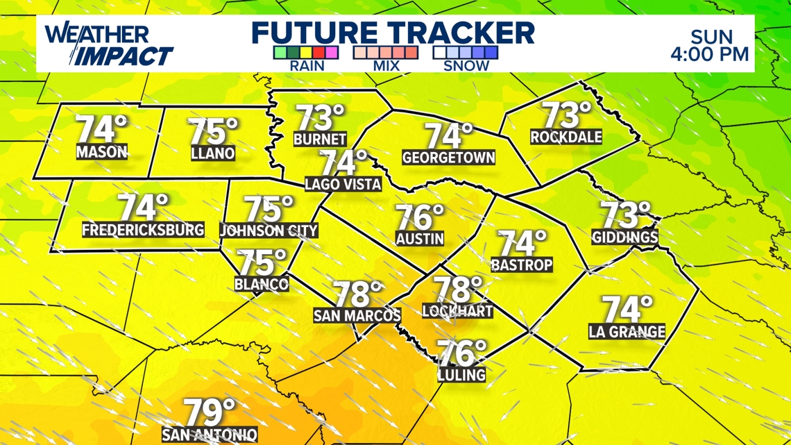
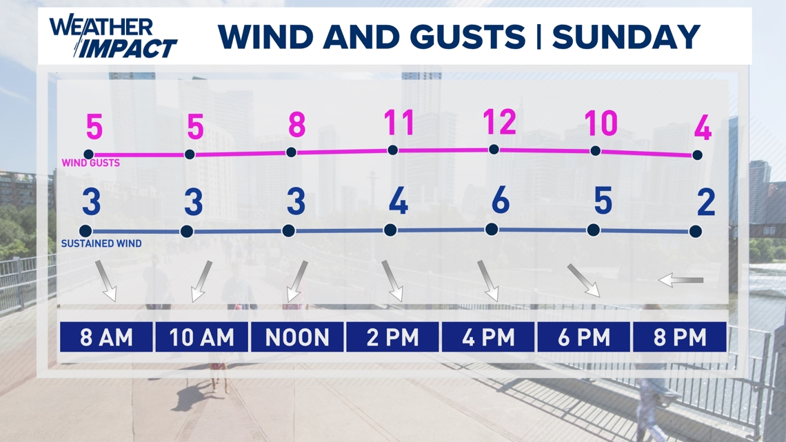
Sunday, March 16
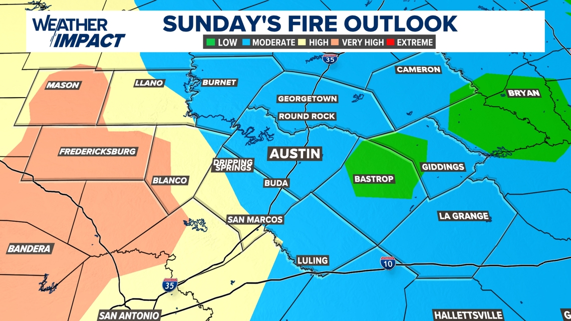
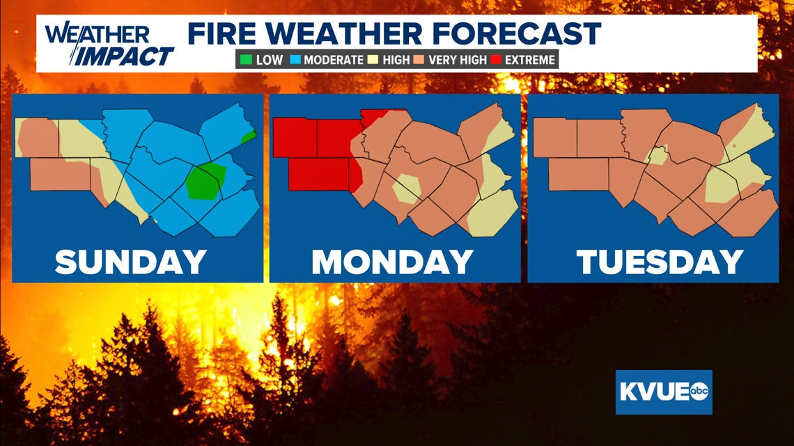
We’re tracking temperatures similar to Saturday, but we do not expect to be as windy as we were on Saturday. This will allow for improved fire weather conditions, although we could see gusts in Gillespie County get to 25 mph.


With all of this in mind, portions of the Hill Country are a step down in fire danger, although Gillespie County is still in the “very high” fire danger category for the afternoon hours.

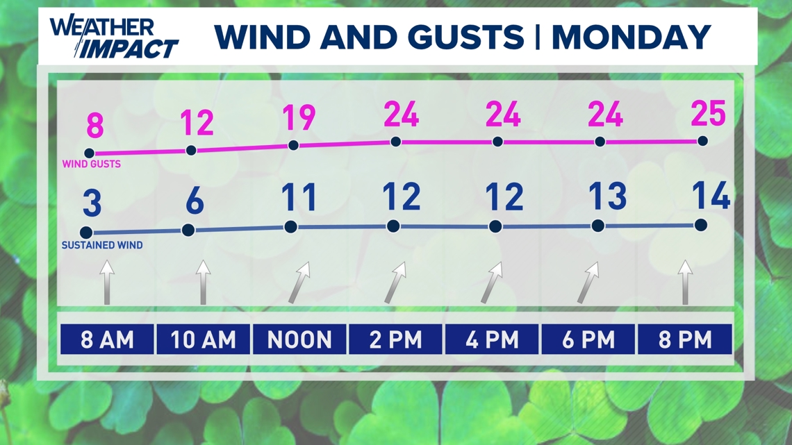
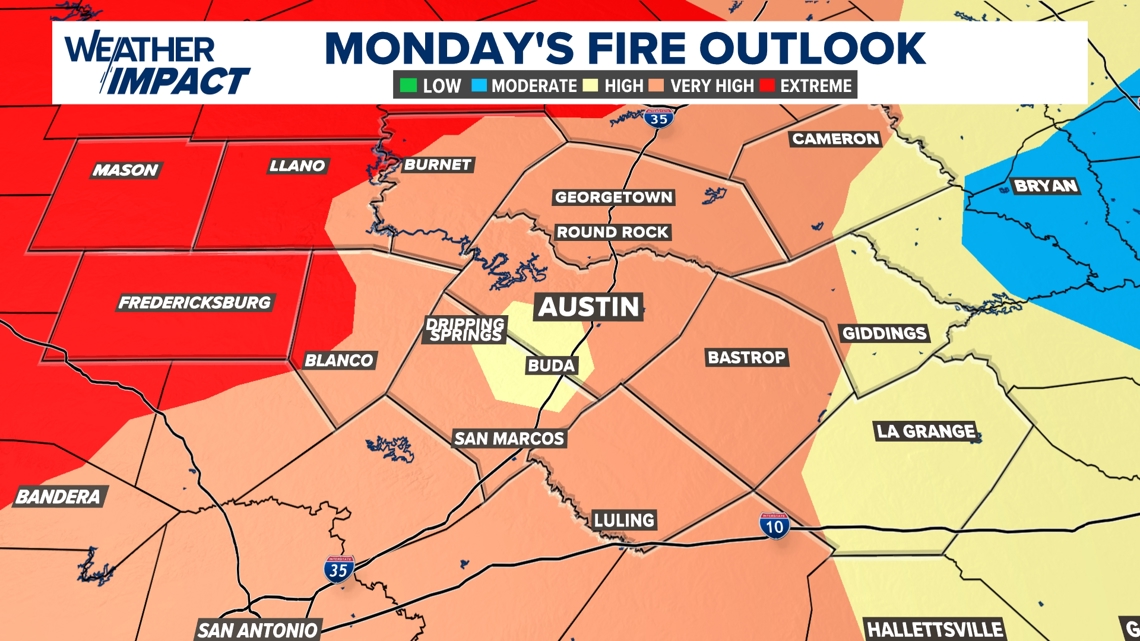
Monday, March 17
We’re tracking temperatures that’ll warm up for the afternoon hours as winds funnel in from the south and southwest. We’re tracking highs in the lower 80s under mostly sunny skies, but wind gusts could get into the 25 mph range in the Austin metro and 30-35 mph in our outlying areas.


As a result of the drier conditions and stronger winds, we’ll have “extreme” fire danger forecast for Monday afternoon in the Hill Country, with “very high” fire danger for most everyone else.

Bottom line
While we do have a lull for Sunday in terms of fire weather concerns, that does not mean that it’s all over just yet. This is especially true when we look at the precipitation that’s fallen – or lack thereof – this past winter season. We definitely need to be paying close attention to anything that’ll cause a spark and avoid any and all outdoor burning.

Stick with the KVUE Weather Impact Team for all the latest on your forecast.
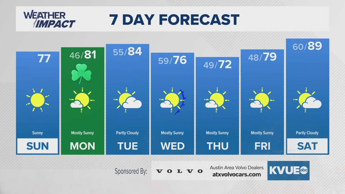
Your seven-day outlook is below.