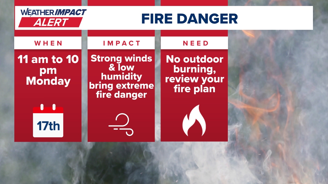
AUSTIN, Texas — We’ve issued yet another Weather Impact Alert Day for Monday afternoon as extreme fire danger persists across portions of Central Texas, including in the Hill Country where we’ve already seen a large wildfire burn.
Here is what we’re tracking.
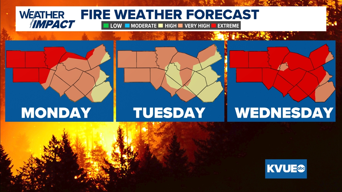
Monday’s fire danger
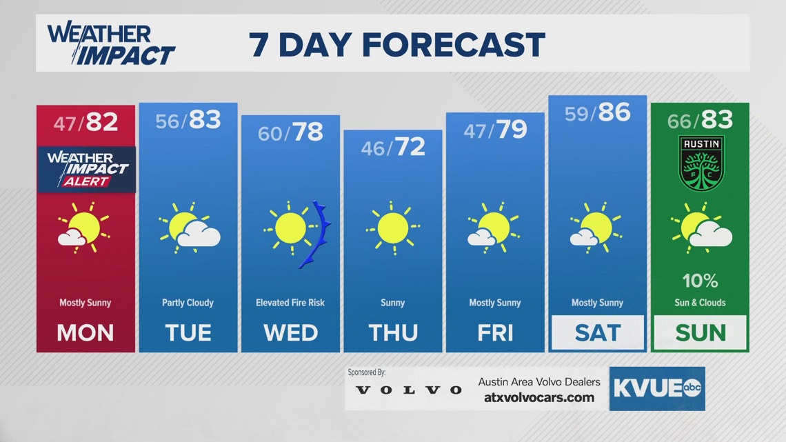
While we do start off St. Patrick’s Day on Monday with some low clouds, we expect those clouds to mix out by the afternoon hours, and a sunny afternoon takes hold with highs in the lower 80s.


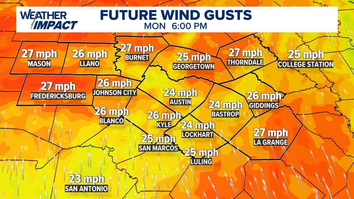
The main story with tomorrow is the wind, which could gust up to 25 mph in the Austin metro, but slightly higher than that in the Hill Country and Coastal Plains.

With the wind, as well as the dry soils caused by this winter’s lack of precipitation, we’re tracking extreme fire weather conditions for the Hill Country, and “very high” fire danger for most of the rest of Central Texas.

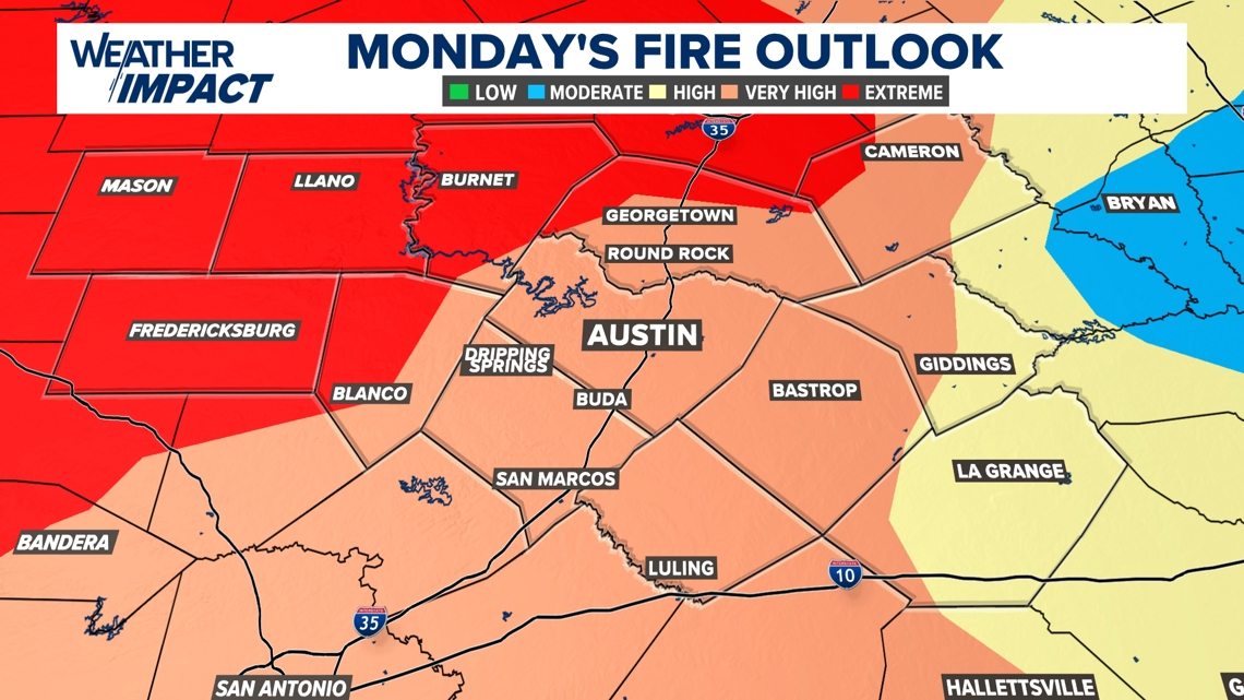
As a result of this, we have issued a Weather Impact Alert Day for Monday. While Williamson and Lee counties are the only counties in Central Texas that are not currently under a burn ban, any outdoor burning is still strongly discouraged, and we encourage mindfulness of anything that may cause a spark.

A look ahead
Monday won’t be the only day in which we are tracking extreme fire danger across Central Texas. We’re also tracking very high fire danger for most of the KVUE area for Tuesday, and with a front coming in from the north for Wednesday, we’re tracking another bout of widespread extreme fire danger for most of the KVUE area, according to the Texas A&M Forest Service.
Don’t be surprised if another Red Flag Warning is issued for most of the KVUE area.

Stick with the KVUE Weather Impact Team for all the latest on your forecast.
Your seven-day outlook is below.