AUSTIN, Texas — We’ve had an active weather pattern over the last few days, with good, beneficial rainfall as we made our way through Thursday and Friday. And while Saturday did have a bit of a lull, we saw a few scattered storms late Sunday morning in Williamson County that produced two separate reports of hail that was one-inch in diameter.
With that system now passed, we’re tracking a dry lull for the start of the upcoming week before big changes come once more toward the end of the week.
Here’s what we’re tracking.
Cool start to the week
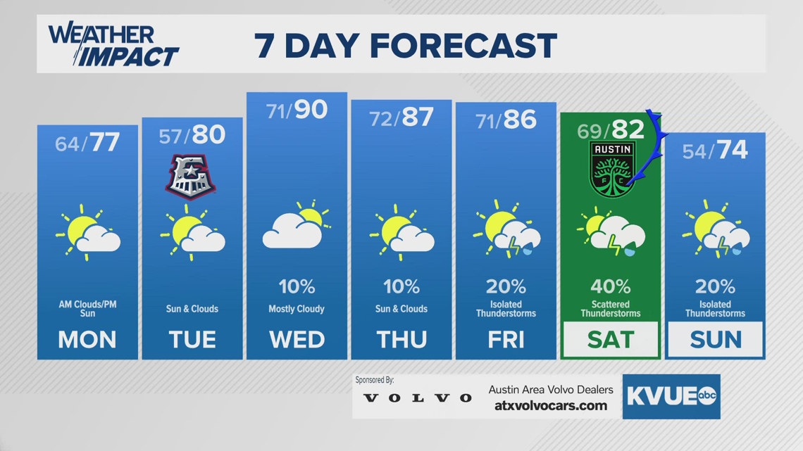
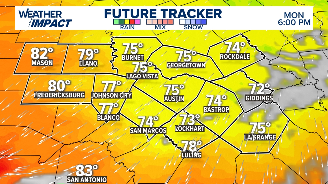
A frontal boundary is et to come in early Monday morning that’ll bring in a shot of slightly cooler and drier air, although we might have an isolated shower or two during the overnight hours of Sunday night into Monday morning, before we clear out for the afternoon.
With the northerly flow in place, we’re tracking highs in the mid-to-upper 70s, similar to Sunday’s highs but with drier air.

Warmer for Opening Day
Winds will shift back to a southerly direction Monday night into Tuesday, but not before we drop into the upper 50s for lows. However, we’re tracking a slight warmup to around 80 degrees for Monday afternoon, with a few more clouds for the afternoon hours.
The rain should stay at bay, and that’s good news because the Round Rock Express have their home opener against Toledo at Dell Diamond. A key note with this game is that winds will be from the south at around 10-15 mph, and this could mean, with home plate at Dell Diamond facing north, winds could carry fly balls farther than normal, and with the warm temperatures, we could be seeing balls jumping out of the ballpark.


Rain chances increase
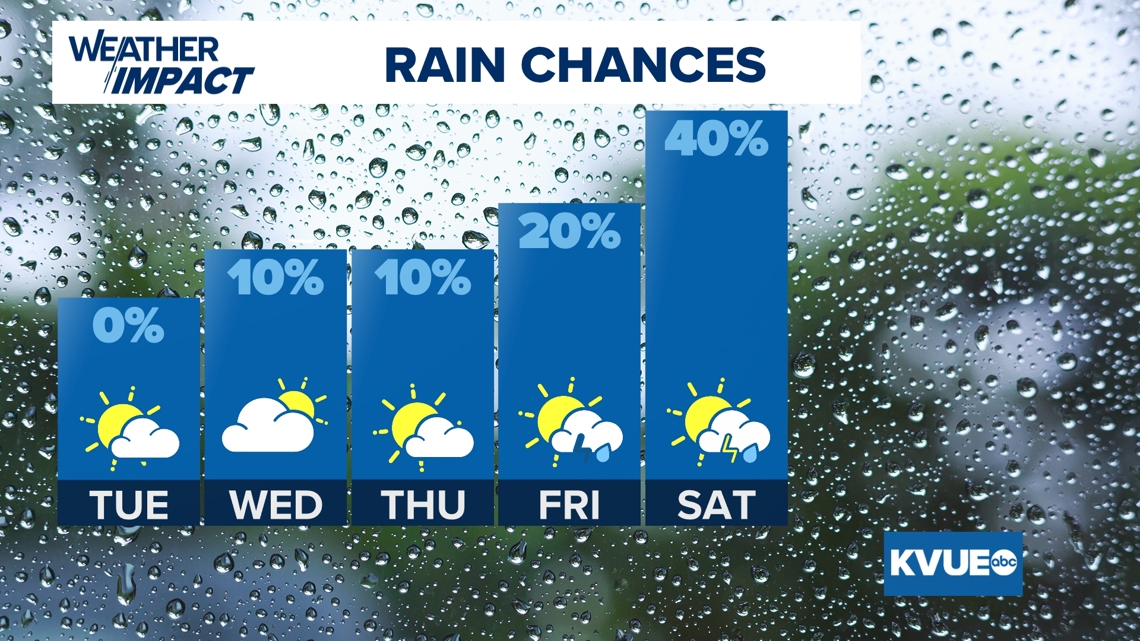
As we head into the latter part of the week, we’re tracking another system that could bring some beneficial rain to portions of Central Texas, with the best rain chances preliminarily coming for the start of next weekend.
We’re tracking a 40% chance for Saturday, but this obviously can and will change according to trends.

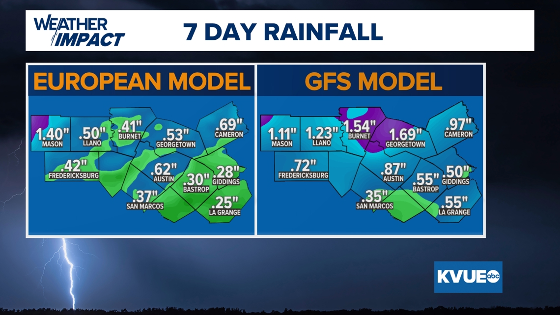
Additionally, we’re tracking rainfall totals that could bring in around a half-inch to an inch-and-a-half of rainfall, with both long range models pointing at the heaviest amounts mostly taking place in our northern counties, the European model scoring the highest totals in the northern Hill Country and the American GFS model planting the heaviest rain in the Austin metro and points to the north along I-35.
Again, this can fluctuate over time, so stick with us as we track these trends for you.

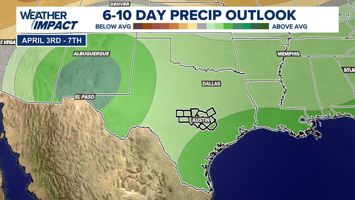
As we’re tracking these rain chances, we’re also watching the active pattern continue even past the seven-day forecast, as the six-to-10 day rainfall outlook has Central Texas having a higher likelihood of above-average precipitation, which would be beneficial to our drought situation.

Stick with KVUE for all the latest on your forecast.
The seven-day forecast is below.

