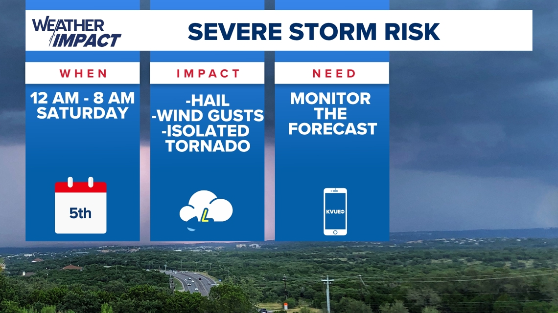
AUSTIN, Texas — The humidity and warmth have been a bit oppressive this week, and all that moisture and energy will eventually send storms through Central Texas into Saturday morning.
What to expect
A cold front shifts towards the Central Texas Hill Country late Friday night, and our first round of strong and potentially severe thunderstorms takes place as early as midnight Saturday.
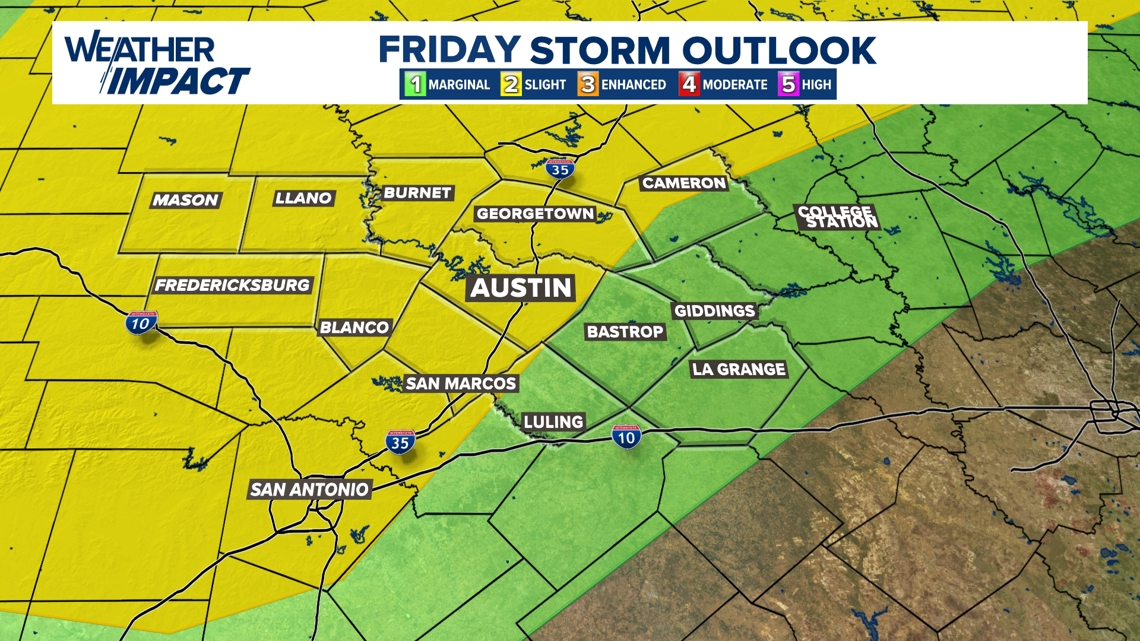
This event will have the chance for severe weather. Areas along and west of the Interstate 35 corridor will be in a Level 2 out of 5, “slight” risk. The neighboring Coastal Plains will be in a Level 1, “marginal” risk.

Friday Storm Outlook

Risk factors will include the possibility of large hail and damaging winds, and we can not rule out a brief spin-up tornado.
You and your family will want a way to get alerts in case a severe thunderstorm warning is issued, especially because many of us will be asleep as thunderstorms start moving in.
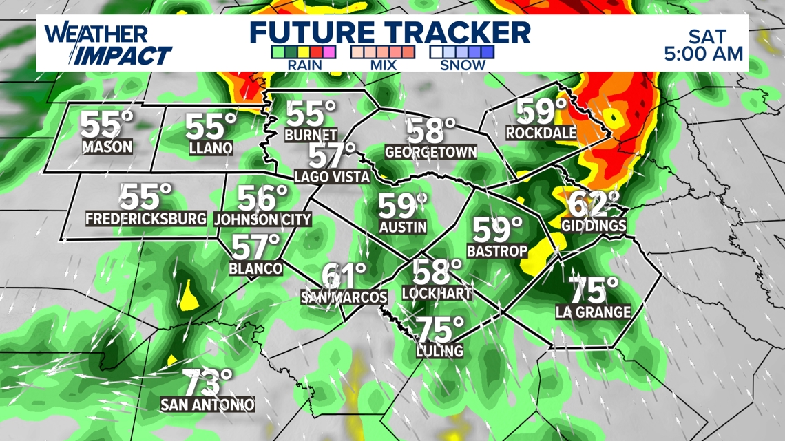
Timeline
Our first round of storms is expected just after midnight Saturday, but there could be a few isolated storms Friday night ahead of the front. The squall line will enter into the Hill Country first and then push east into the I-35 corridor.

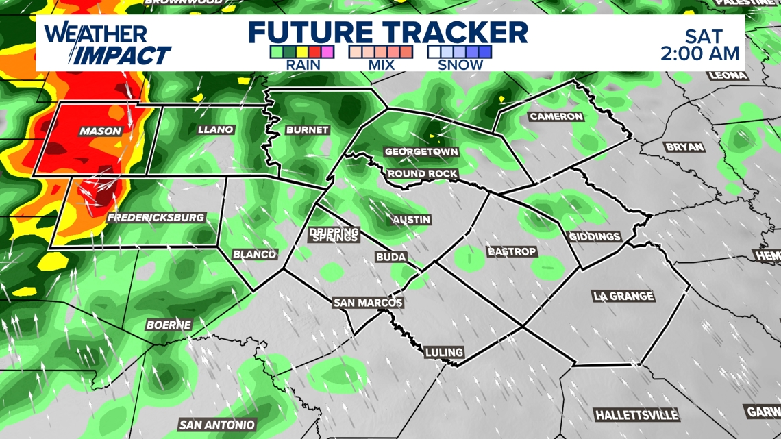
The heaviest rains and strongest storm activity is expected to pass through by 6 a.m., but we likely won’t see majority dry conditions until 8 or 9 a.m. on Saturday.
Mostly cloudy skies prevail by noon. There could be a few spot showers or storms late Saturday night, but the atmosphere will be worked over by then, with no major severe risk anticipated.

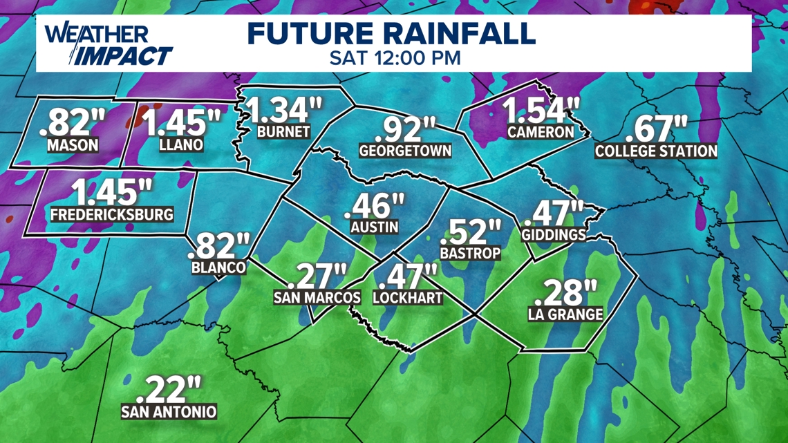
These storms may sound scary and wake a few of us up Saturday morning, but overall, this is another great opportunity for some drought-fighting rain here in Central Texas. Rainfall rates could be around 1-2″ per hour. Most areas will receive between .25″-.50″ inches of rainfall.

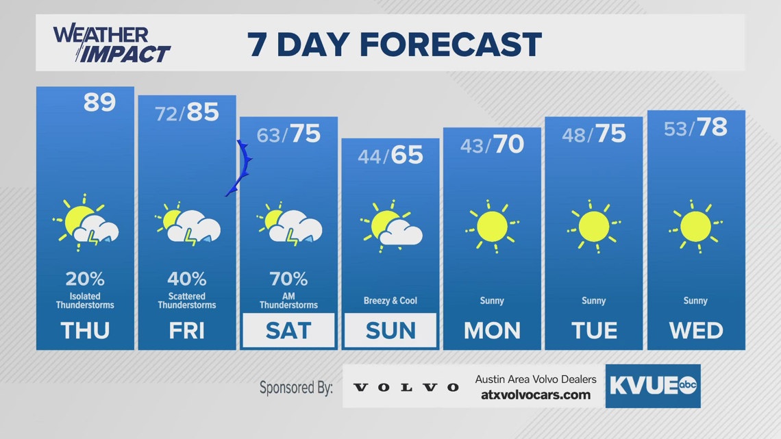
7-day forecast
Cooler, brighter conditions will finally return Sunday into Monday.