AUSTIN, Texas — Many in the Hill Country saw a decent amount of rainfall on Saturday morning. According to gauges by the Lower Colorado River Authority (LCRA) and radar estimates, some areas in Gillespie County got up to 2.5 inches of rain, which will certainly make a dent in the drought.
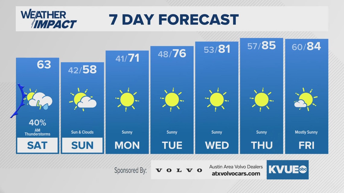
With drier air now in place, we’re tracking much chillier temperatures for Saturday and Sunday, especially Sunday morning, before we warm up for next week.
Here’s what we’re tracking.
Chilly Sunday morning
We’re tracking a brisk northerly flow that will really bring in colder air for Saturday night into Sunday morning. The Austin-American Statesman Cap10k race, emceed by our very own Chief Meteorologist Hunter Williams, will take place early Sunday morning, with temperatures in the lower 40s under a mix of sun and clouds.

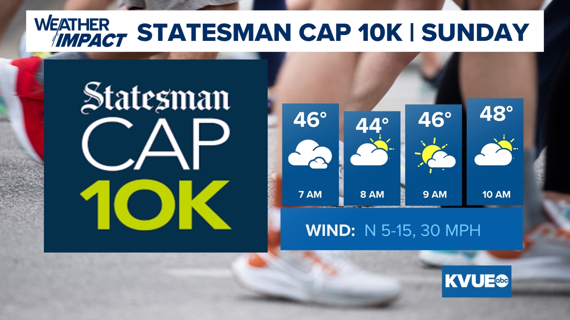
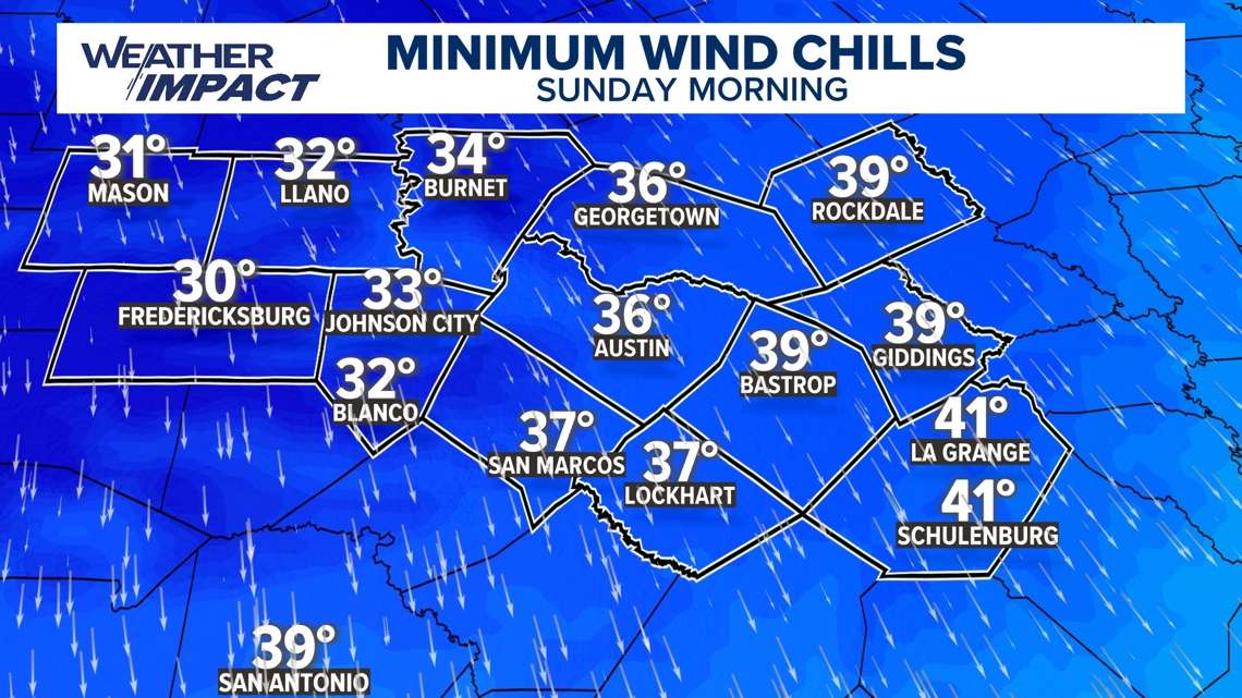
Winds will mean “feels-like” temperatures in the upper 30s for most of Central Texas, but portions of the Hill Country could be waking up feeling like below freezing, which is rare for April.

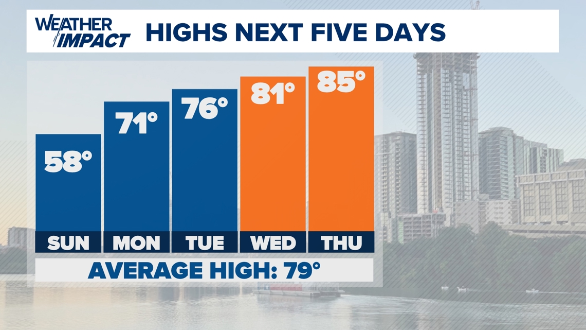
After highs only get to the upper 50s for Sunday, things do trend more towards as we head into next week.
Warmer next week
While Sunday will be cold for April, we are tracking an area of high pressure arriving from the southwest as we start next week.

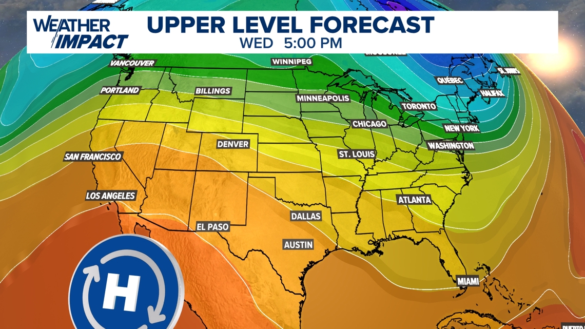
As a result of this, we’re tracking temperatures gradually warming throughout the week. A dry southerly flow will accompany the high-pressure system, and dry air typically heats up faster than moist air. Highs by midweek will be in the lower to mid-80s.

Stick with KVUE as we continue to track this forecast.
Your seven-day forecast is below.