AUSTIN, Texas — With the fire weather risk behind us, we’re tracking muggier and hotter temperatures for Monday before we cool down for the rest of the week and storm chances return for Easter weekend. Here’s the latest.
Scorching Monday
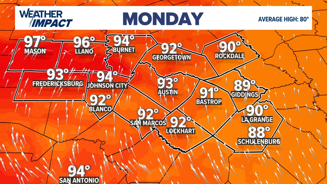
We’re tracking highs that could get to the lower 90s for the afternoon in most spots Monday across Central Texas. We’re also tracking some areas that could get to the upper 90s, especially in the Hill Country, where there will be more compressional heating ahead of a frontal boundary.

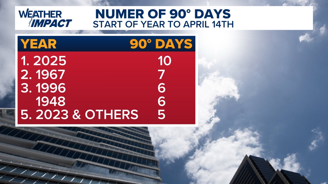
The 90-degree heat is nothing new for Central Texas, as we’ve already had 10 such days so far in 2025 – the most in history through April 14 at Camp Mabry.
To put this in perspective, 2023 had only five such days up until this point, so we may be on track for a hotter summer in Central Texas.

However, changes are on the way, especially for the weekend.
Storms for Easter
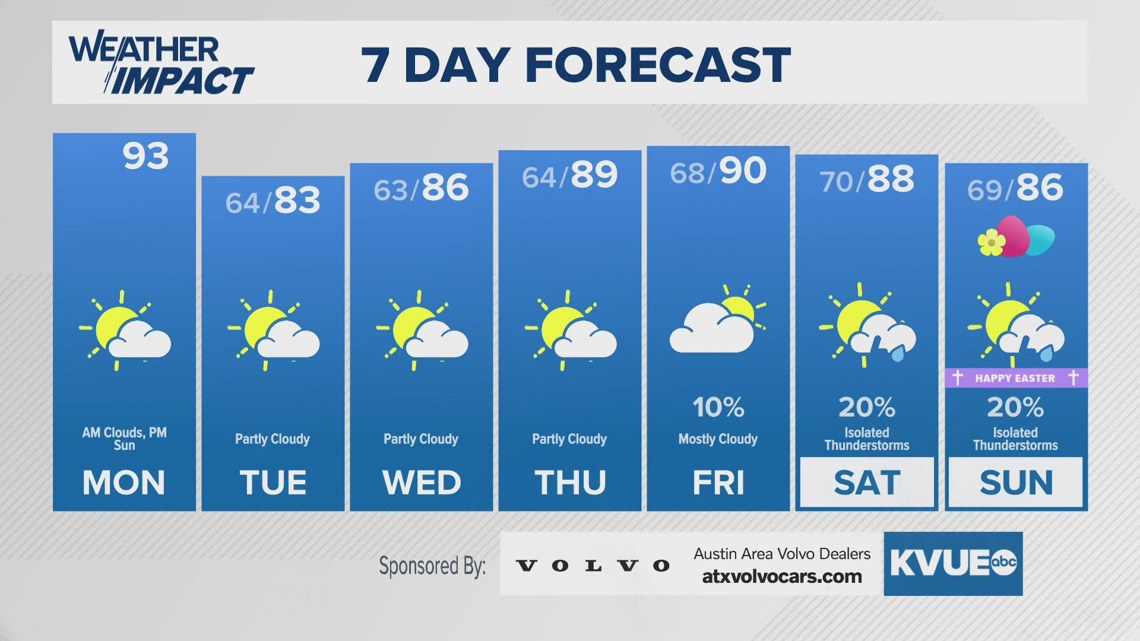
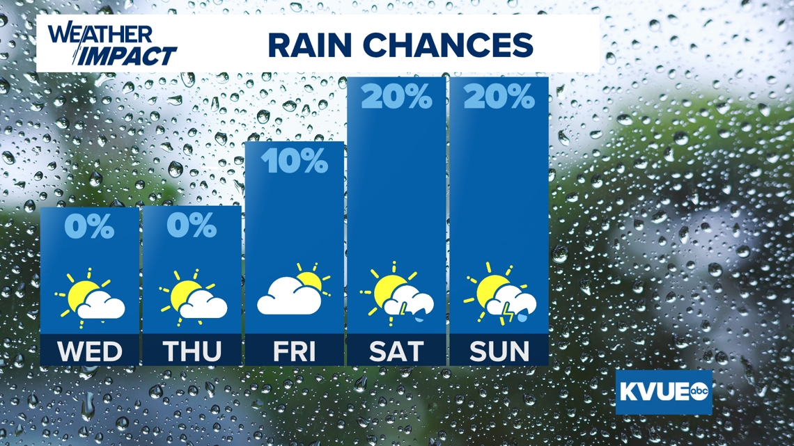
We’re tracking an isolated storm chance for Saturday and Easter Sunday, with highs getting to the mid-80s after highs around 90 for Good Friday.

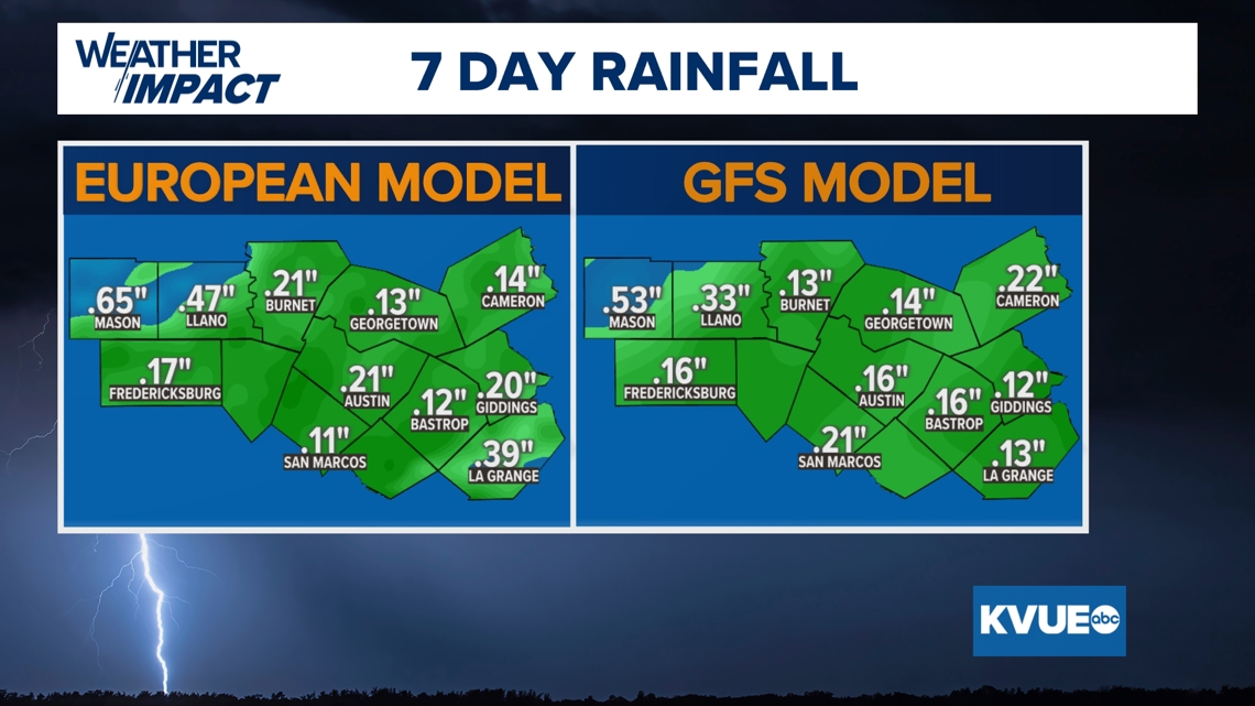
As a result, many might be wondering how much rain we could receive, especially given that much of Central Texas is in an “extreme” or “exceptional” drought situation.
Many areas don’t look to receive all that much, with only the Hill Country having the best shot of even 1 inch of rain. Most everyone else will receive between a quarter of an inch to a half an inch of rain.

Stick with KVUE for all the latest on your forecast.
Your seven-day outlook is below.