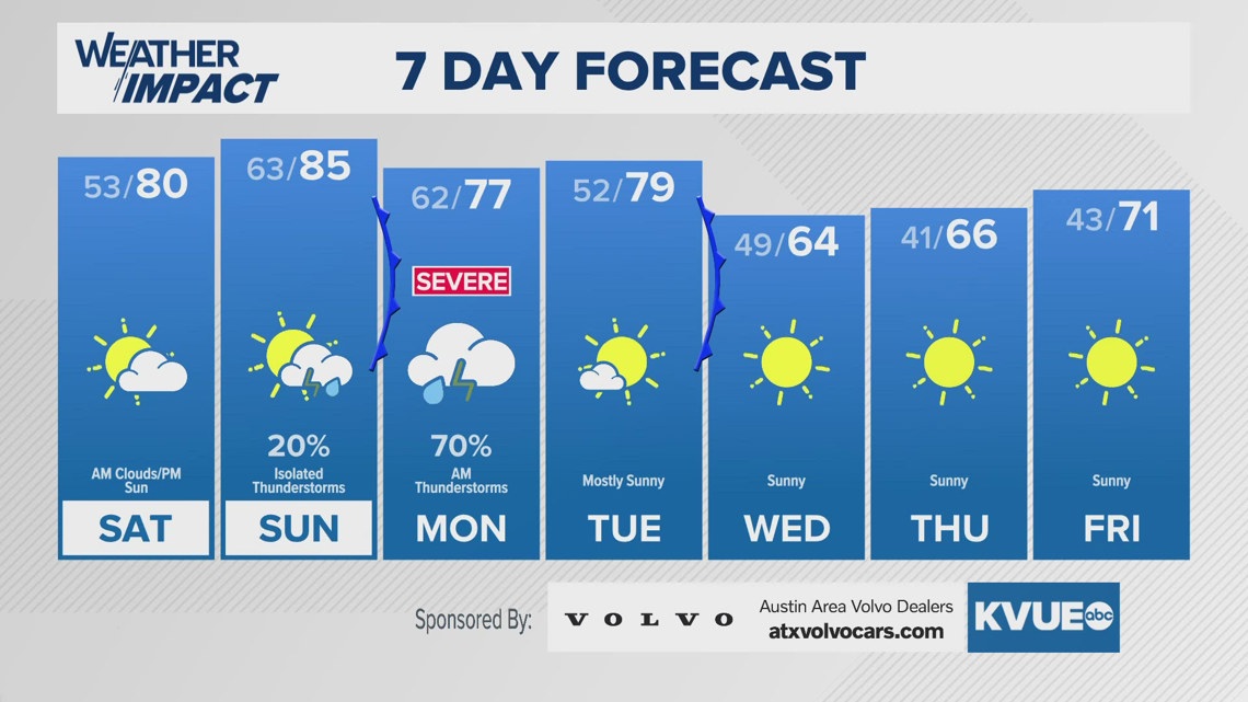
AUSTIN, Texas — After a quiet start to the weekend, our weather pattern turns busy again for next week.
We’re tracking two cold fronts. The first will move through Monday morning with a risk for severe storms, and the second will push through Tuesday night bringing a pretty big cool down for the middle and end of the week.
We’ll start the week with a storm chance. The front will be moving into the Hill Country in the predawn hours of Monday and will be moving into the Austin metro by 9 or 10 a.m. We expect a solid line of storms to sweep across our area from west to east.
Most, if not all of the wet weather, should be moving away to the east by midday Monday. The afternoon will be breezy with high temperatures in the 70s.

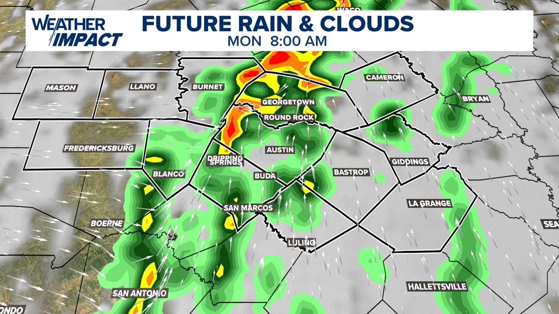
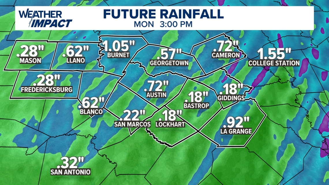
Rainfall totals on average will be a quarter inch to a half inch for much of Central Texas, especially west of I-35. A few pockets could see 1 inch or more of rain. The risk of flooding at this time is very low.

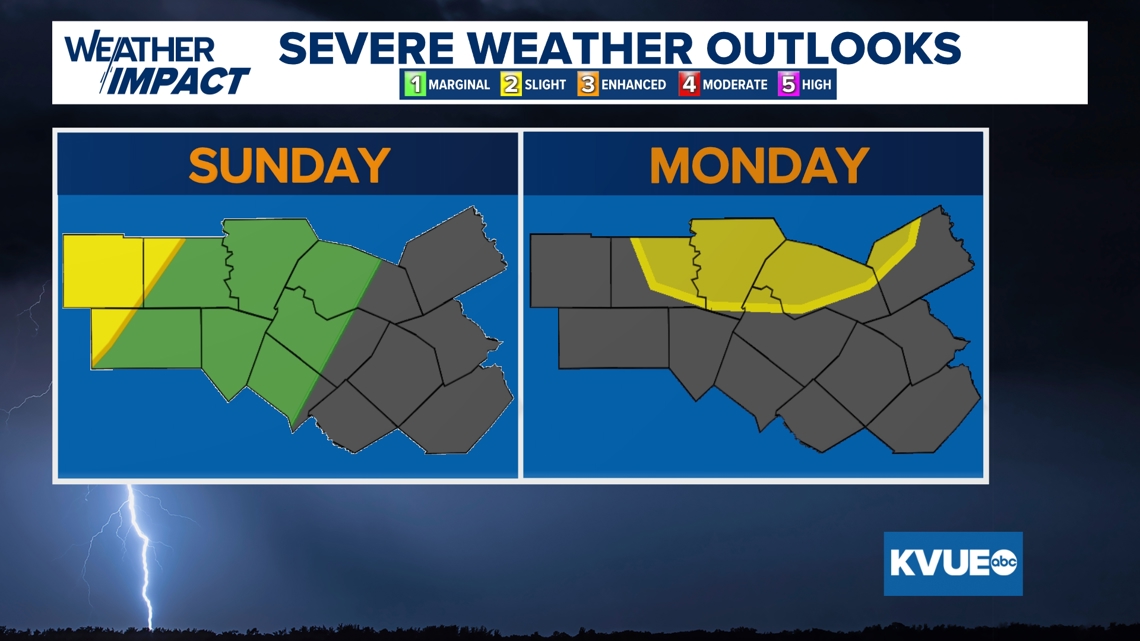
There will also be a risk of severe storms. The Storm Prediction Center includes the western Hill Country in a Level 2 of 5 severe risk Sunday night into early Monday morning. Then the northern I-35 corridor is in a Level 2 of 5 risk for the start of Monday.
At this time, widespread severe weather is not expected, but one or two strong to severe storms are a possibility. Small hail and gusty winds will be the main threats.

A second cold front will push through Central Texas Tuesday night into early Wednesday morning. This second front will not bring any additional rain, but it will bring in a much cooler air mass for the back half of the week.
We still need to fine-tune the exact duration of the cooldown, but we should get at least a few days with high temperatures in the 60s to low 70s.
At the same time, mornings will be our coldest so far of the season with 30s and low 40s across all of Central Texas. Thursday morning will likely bring some patchy frost and maybe even a light freeze to parts of the Hill Country.

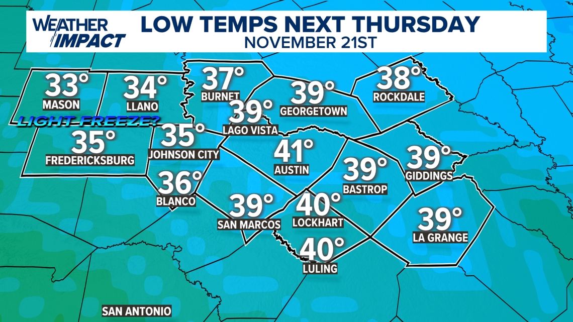
The KVUE Weather Team will continue to closely monitor this developing forecast. In the meantime, the extended forecast can be found below:

