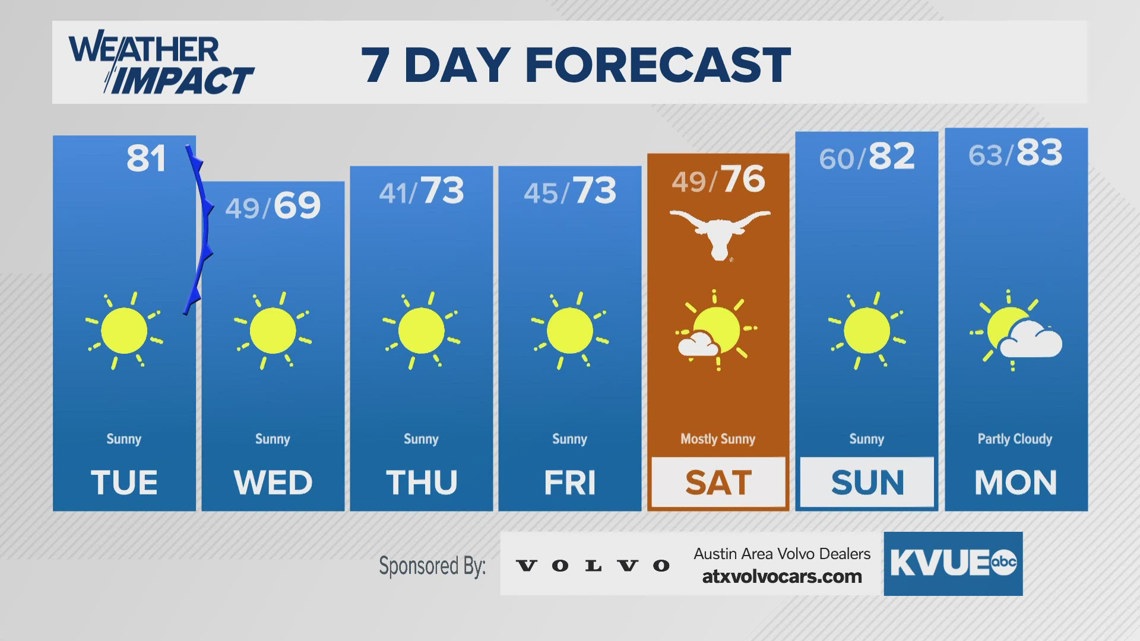
AUSTIN, Texas — We’ve been waiting for cooler temperatures to “stick” the past few weeks, as Central Texas has been teased with a few minor cooldowns. Now, a cold front entering the region Wednesday morning will finally bring a few days of cooler conditions for the end of the workweek.

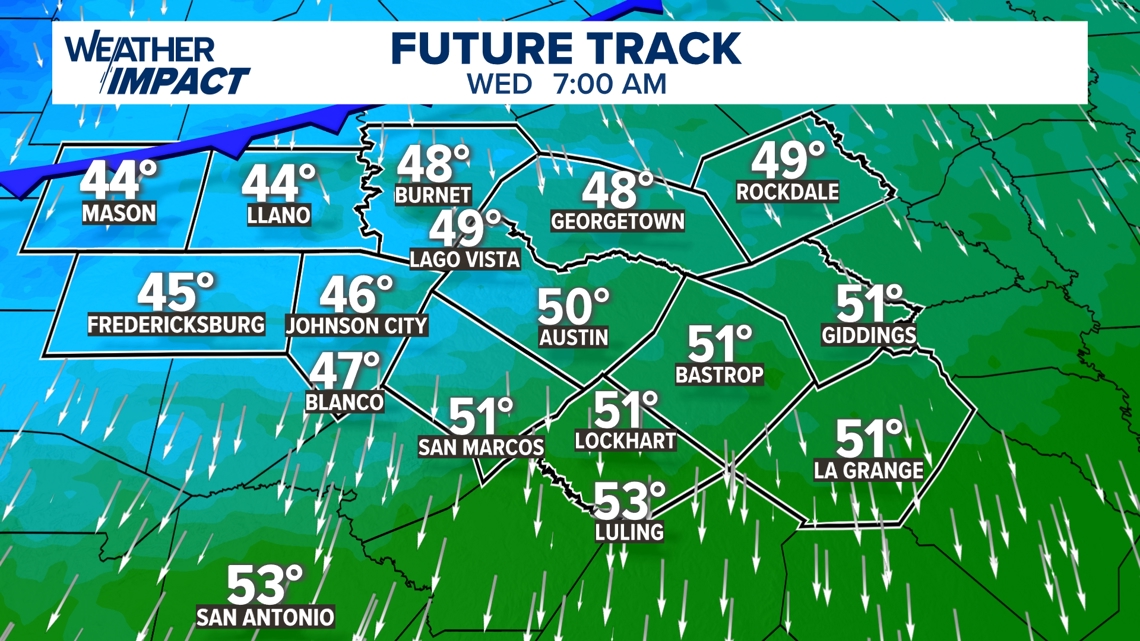
The front will pass Wednesday morning from the Hill Country south and east through the Coastal Plains. There won’t be enough cold air behind it to notice a major shift in morning temperatures, but cool conditions will get more noticeable moving towards Wednesday afternoon and Thursday.
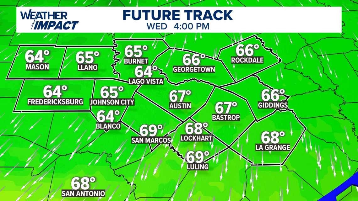
Wednesday afternoon, high temperatures aren’t expected to make it out of the 60s areawide. So far this fall, we’ve only had a few days with highs in the 60s back in early September, so it’s been awhile.

Walking out the door Thursday and Friday morning, a jacket will be needed.

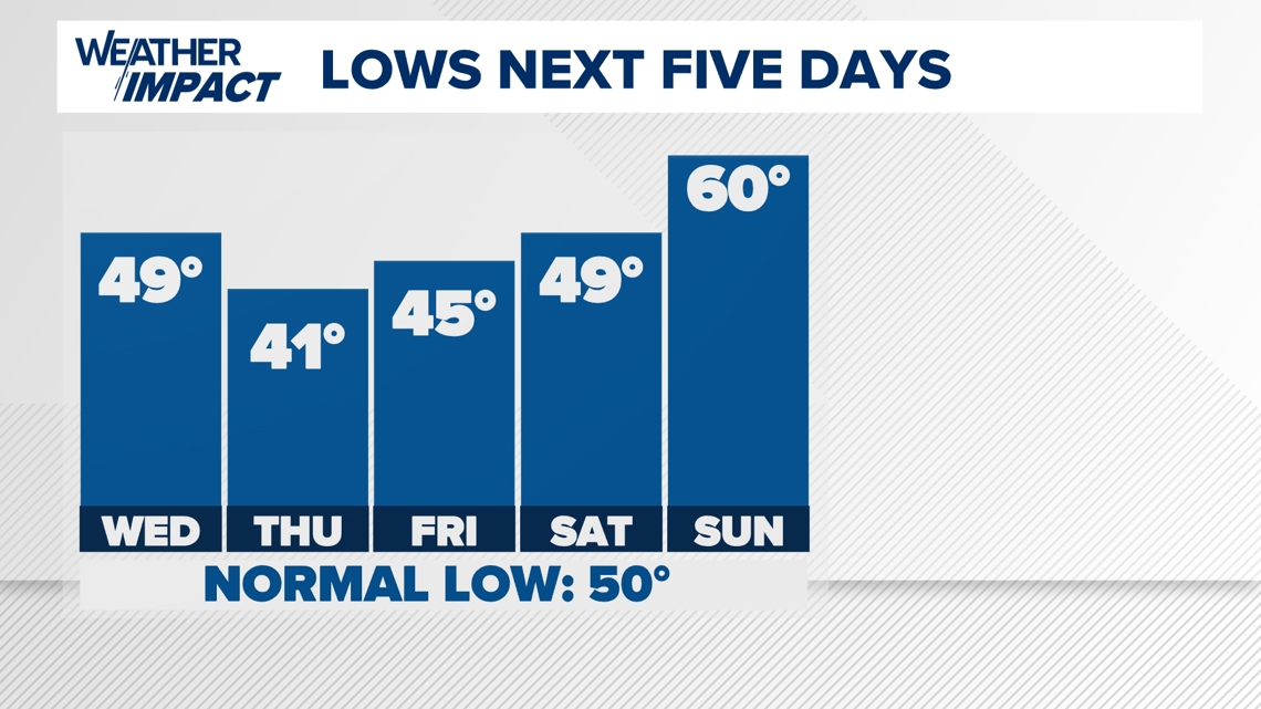
Lower 40s can be anticipated on the way to work or school, as many neighborhoods will dip to the 30s on the outskirts of town.

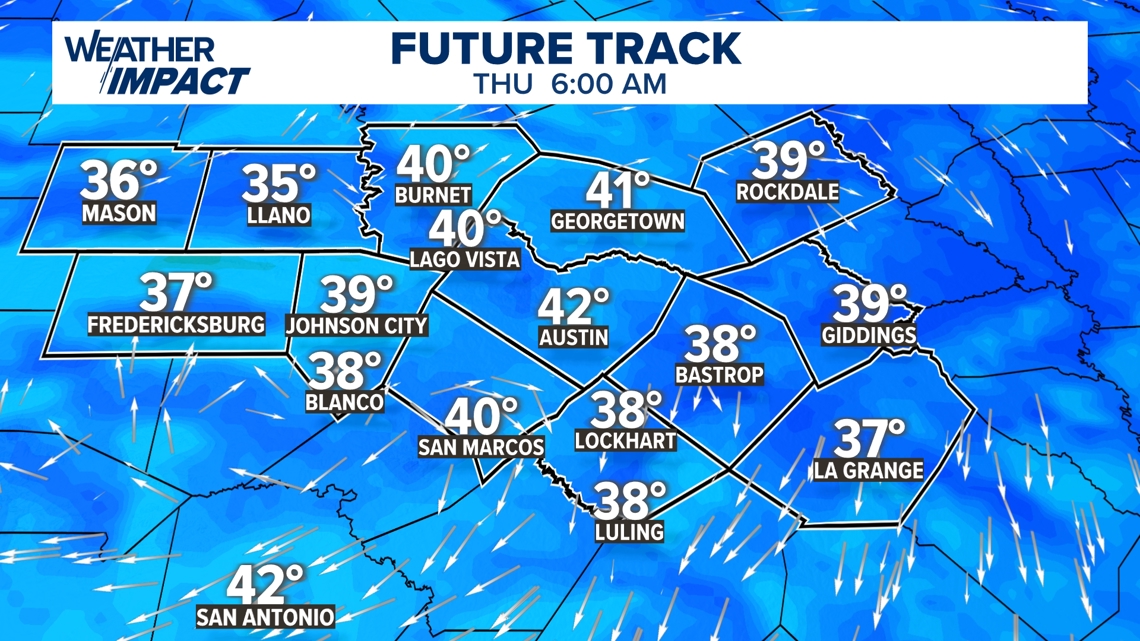
Regional temperatures will be short of a widespread frost or freeze, but patchy frost may be possible for some areas in the Hill Country that could dip towards the freezing level. Conditions warm up quickly by the weekend.
Here is our latest 7-day forecast.

