AUSTIN, Texas — While we’ve tracked quite the chilly week compared to weeks past during this winter season, we had widespread rain on Thursday, which was very beneficial for our drought situation.
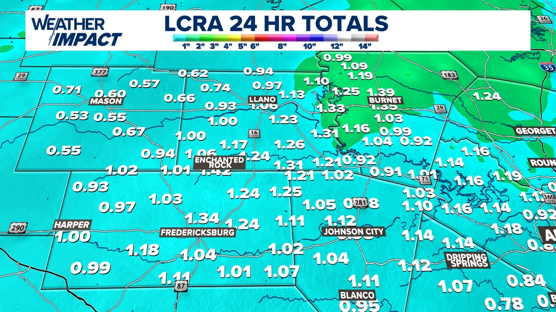
Rain totals, especially in the Hill Country and towards areas like Lake Buchanan, saw some of the Hill Country’s highest amounts of an inch area-wide.
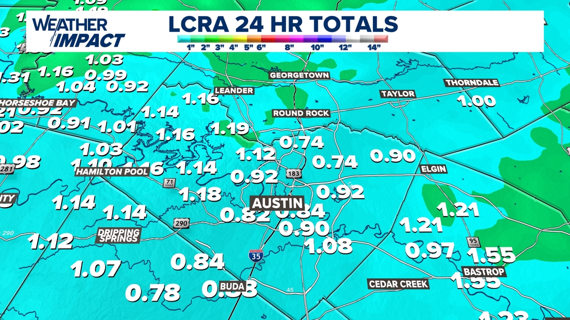
We even had some healthy amounts in the Austin metro as well. Most of the area received around an inch of rain, but some areas got nearly 1.25 inches in some places.
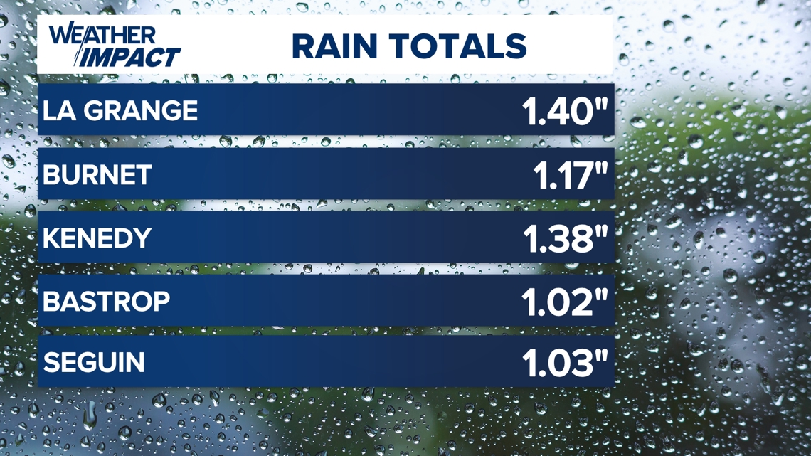
Some other areas that were big winners included La Grange and Burnet, which saw rainfall totals exceed one inch.
Thursday’s rain totals in the Hill Country


Thursday’s rain totals in the Austin area


Rain totals in other areas


How much ice fell in Central Texas?
A question likely being asked by many is whether or not we have measurable ice totals.
Right now, the only reports in the Hill Country were of very light icing, mainly on elevated surfaces but not on any roadways. Thus, we do not have any measurable totals to share at the moment, but we’ll keep you updated if we do.
Additionally, we have been monitoring the drought situation for the past several years. While we did receive good rain totals on Thursday, the rain fell too late for the drought monitor to record it for this week. Thus, we saw a statewide increase in “severe” and “extreme” drought conditions, but thankfully, it was by only 1%.
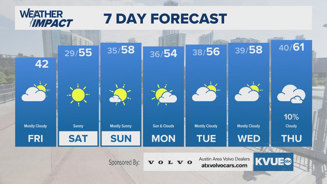
If you’re looking for more rain to arrive for the weekend or early next week, you’re out of luck. We do expect somewhat of a warmup, but we do not have any real rain chances for the next week. Your seven-day outlook is below:

