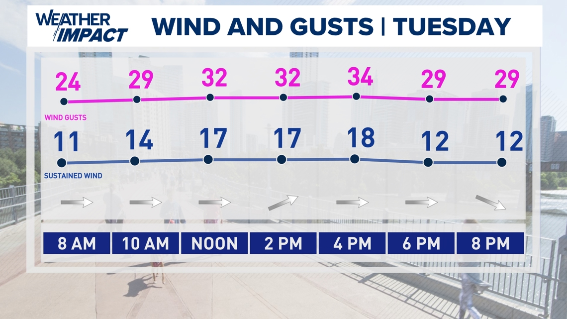
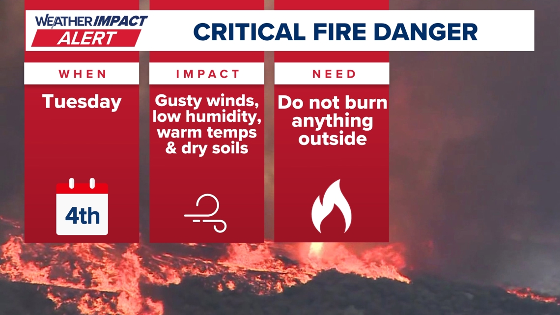
AUSTIN, Texas — We’re tracking much drier air behind a strong Pacific front that arrives Monday night into Tuesday morning. While we’re expecting some showers and storms along the frontal system, it’s what’s behind the front that has prompted a Weather Impact Alert Day for Tuesday.
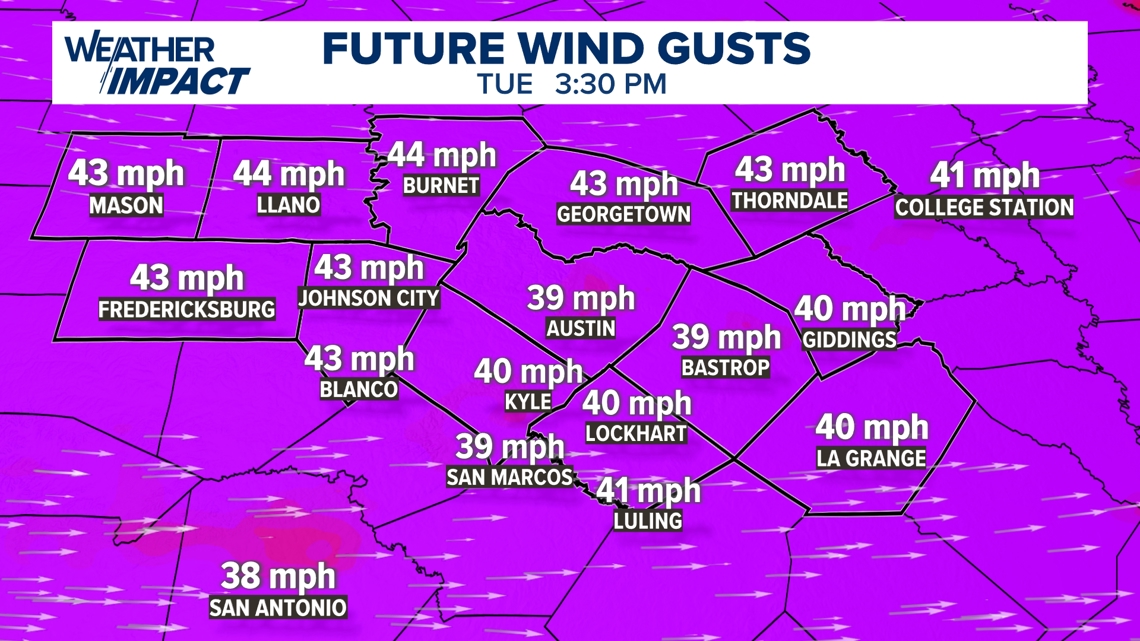
This is because behind the cold front, we’re tracking winds that could gust up to 40 mph in the Austin metro and up to 50 mph in sections of the Hill Country.


The Texas A&M Forest Service has issued an extreme fire risk for sections of the Hill Country. Those areas, as well as the Interstate 35 corridor, are under a Fire Weather Watch until Tuesday night, and we fully expect those same counties to be placed under a Red Flag Warning for that period come Monday.

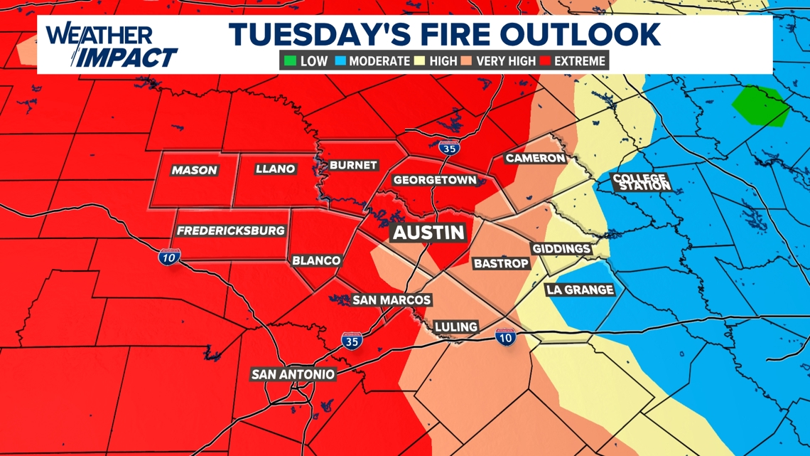
With all of this in mind, we urge everyone in Central Texas not to burn anything outside at all on Tuesday and be very mindful of anything that may cause a spark. Even the smallest sparks can cause wildfires that can easily burn out of control in conditions like this, so it is important to refrain from outdoor burning for any reason.
Be sure to have a plan in case you are told to evacuate, and if officials issue an evacuation order, do so immediately.

Continue to follow the KVUE Weather Impact Team for more on this situation as we continue to track the extreme fire danger in Central Texas.
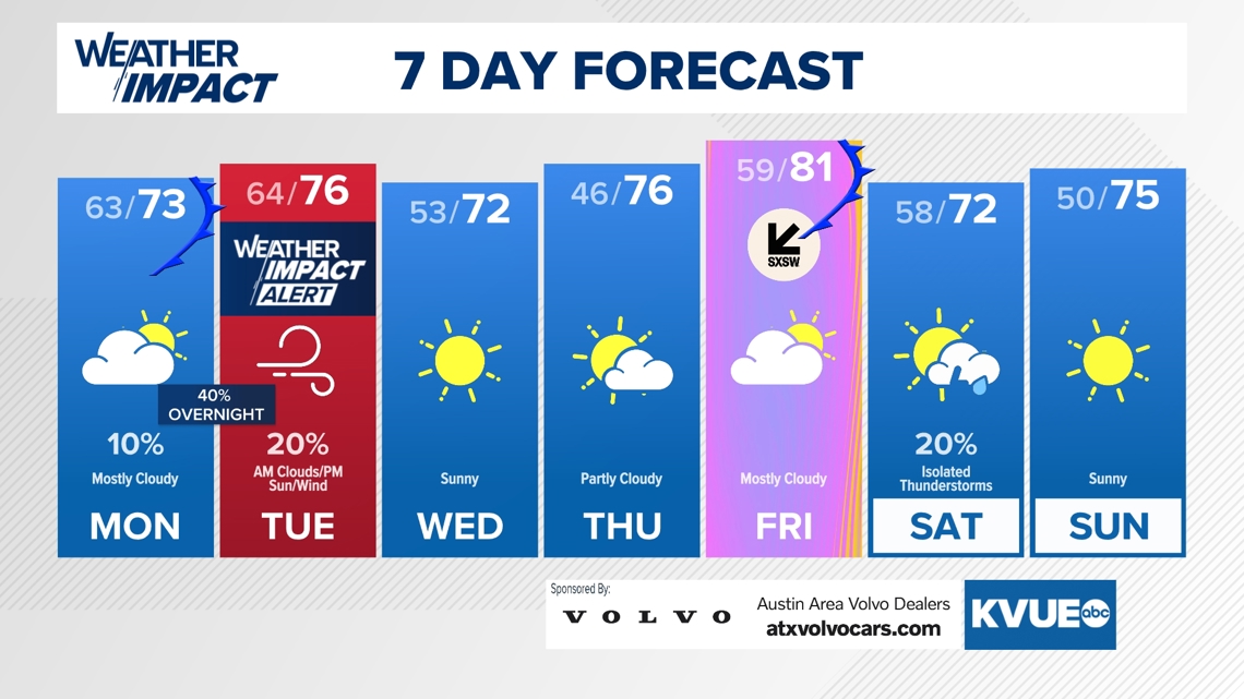
Your seven-day outlook is below.