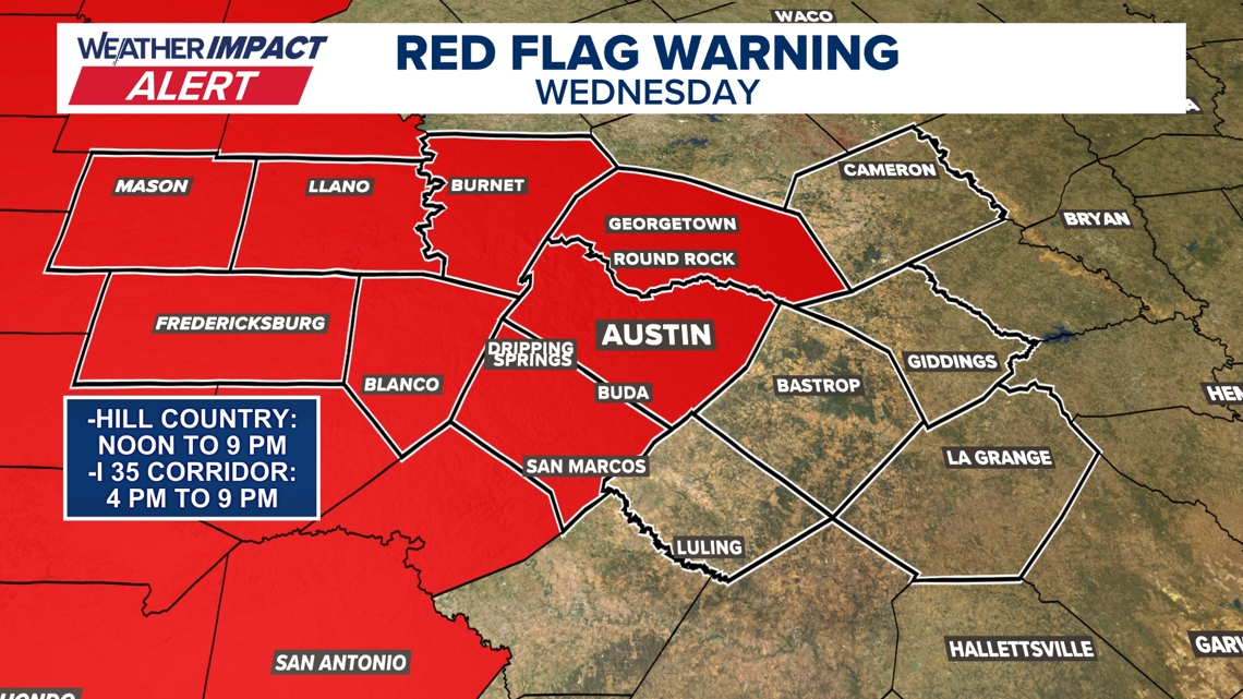
AUSTIN, Texas — We’re tracking our warmest weather so far of 2025, along with an increased risk of fire danger. The KVUE Weather Team has issued a Weather Impact Alert from noon to 9 p.m. Wednesday due to the enhanced fire danger.
A Pacific cold front will move into our area Wednesday afternoon into the evening. Behind it, we’ll see a massive drop in humidity and very breezy winds, raising the fire risk. There’s also a low-end risk for isolated strong storms, especially north and northeast of Austin, but the primary concern is the fire danger.
Wednesday’s Red Flag Warning has been issued for Mason, Llano, Burnet, Gillespie, and Blanco counties from noon to 9 p.m. There is also a Red Flag Warning for Williamson, Travis, and Hays counties from 4 p.m. to 9 p.m.

Fire danger on Wednesday
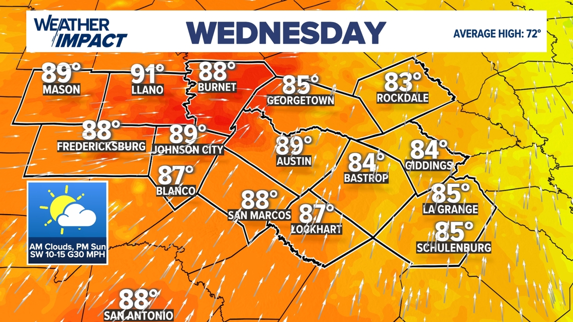
Expect a very warm afternoon with high temperatures in the mid to upper 80s, potentially reaching the low 90s in the Hill Country. As humidity drops, the fire threat will start around lunchtime in the Hill Country and ramp up for the Austin metro and I-35 corridor later in the day.

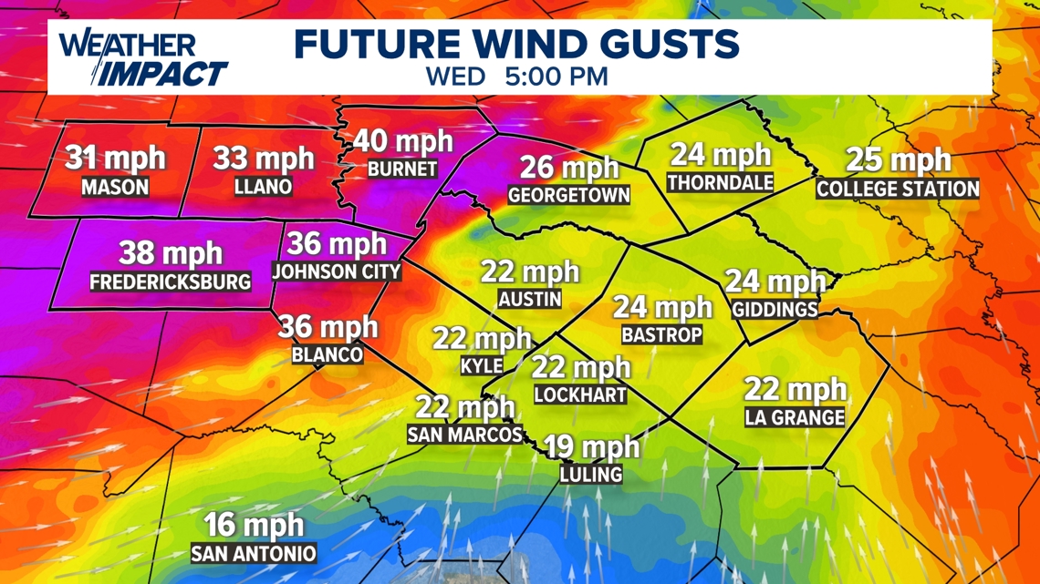
Wind speeds will pick up in the afternoon and evening, with gusts in the 30-35 mph range, potentially higher in the Hill Country. Ahead of this threat, review your fire safety plan with your family and avoid outdoor burning. If you spot a fire, report it immediately.

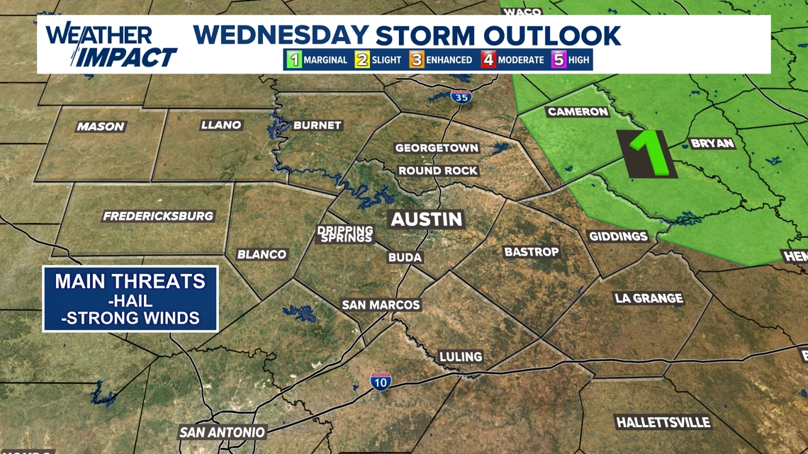
Very low-end severe threat Wednesday evening
While storm chances are low, any storm that forms could be strong. The Storm Prediction Center has outlined a marginal severe weather risk for parts of Lee and Milam counties. The overall chance for storms is only 10 to 20%, and most areas will not see any rain at all.

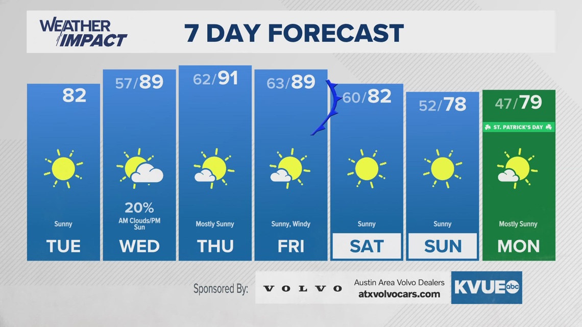
Wednesday’s fire danger kicks off a concerning trend, with another breezy, dry cold front expected on Friday, bringing more fire weather concerns. We’ll continue to monitor the situation closely. For more details, check out the 7-day forecast below: